Laureles geodata
Laureles (Tolima) is a populated place; located in Colombia in America/Bogota (GMT-5) time zone. With population of 1,910 people, there are 811 cities with bigger population in this country. Compared to other cities in Colombia, 75.4% of cities are located further ↑North; 62.1% of cities are located further →East and 69.6% of cities have lower elevation than Laureles. Note1


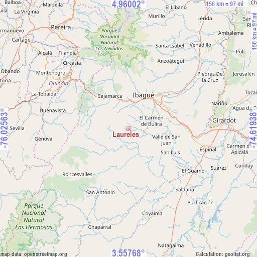
Laureles GPS coordinates[2]
4° 15' 33.012" North, 75° 19' 21" West
| Map corner | latitude | longitude |
|---|---|---|
| Upper-left | 4.96002°, | -76.02563° |
| Center: | 4.25917°, | -75.3225° |
| Lower-right: | 3.55768°, | -74.61938° |
| Map W x H: | 155.9×155.9 km | = 96.9×96.9mi |
| max Lat: | 13.38166° ⇑75.4% North |
| Laureles: | 4.25917° |
| min Lat: | ⇓24.6% South -4.21528° |
| min Long | Laureles | max Long |
| -81.70636° | -75.3225° | -67.06996° |
| W 37.9%⇐ | ⇒62.1% E |
Elevation
Elevation of Laureles is 1724 m = 5656 ft, and this is 574.7 m = 1885 ft above average elevation for this country.
| Max E: |
3342 m = 10965 ft | 30.4% |
| Laureles | 1724 m 5656 ft | |
| Avg. | 1149.3 m = 3771 ft | |
Min E: |
1 m = 3 ft | 69.6% |
See also: Colombia elevation on elevation.city.
Geographical zone
Laureles is located in North Torrid zone (between Equator and Tropic of Cancer). Distance of Equator is 473.6 km =294.3 mi to South.| Distance of | km | miles | from Laureles |
|---|---|---|---|
| North Pole | 9533.5 | 5923.8 | to North |
| Arctic Circle | 6927.6 | 4304.6 | to North |
| Tropic Cancer | 2132.3 | 1324.9 | to North |
| Equator | 473.6 | 294.3 | to South |


Nearby cities:
15 places around Laureles: (largest is in red/bold)
• Anaime
20.4 km =12.7 mi,  318°
318°
• Cajamarca
23.5 km =14.6 mi,  329°
329°
• Chicoral
38.1 km =23.7 mi,  97°
97°
• Coello
16.3 km =10.1 mi,  11°
11°
• Córdoba
43 km =26.7 mi,  290°
290°
• Doima
42.8 km =26.6 mi,  64°
64°
• Ibagué
22.3 km =13.9 mi,  26°
26°
• Ortega
37.6 km =23.4 mi,  162°
162°
• Payandé
25.4 km =15.8 mi,  80°
80°
• Playarrica
24.5 km =15.2 mi,  203°
203°
• Roncesvalles
41.8 km =26 mi,  228°
228°
• Rovira
9.4 km =5.8 mi, 103°
• San Antonio
42.1 km =26.2 mi, 204°
• San Luis
28.9 km =18 mi,  119°
119°
• Valle de San Juan
23.7 km =14.7 mi,  106°
106°
Sources, notices
• [Note1] Compared only with cities in Colombia existing in our database
• [Src1] Map data: © OpenStreetMap contributors (CC-BY-SA)
• [Src2] Other city data from geonames.org with taken over terms of usage.
• [Src3] Geographical zone / Annual Mean Temperature by Robert A. Rohde @ Wikipedia
