Rovira geodata
Rovira (Tolima) is a seat of a second-order administrative division; located in Colombia in America/Bogota (GMT-5) time zone. With population of 6,949 people, there are 410 cities with bigger population in this country. Compared to other cities in Colombia, 75.8% of cities are located further ↑North; 60% of cities are located further →East and 58.4% of cities have higher elevation than Rovira. Note1


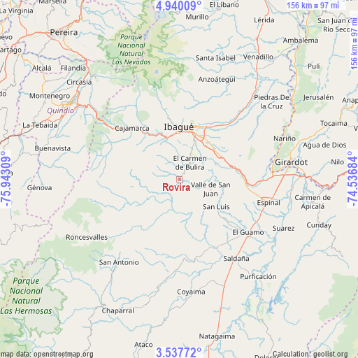
Rovira GPS coordinates[2]
4° 14' 21.192" North, 75° 14' 23.856" West
| Map corner | latitude | longitude |
|---|---|---|
| Upper-left | 4.94009°, | -75.94309° |
| Center: | 4.23922°, | -75.23996° |
| Lower-right: | 3.53772°, | -74.53684° |
| Map W x H: | 155.9×155.9 km | = 96.9×96.9mi |
| max Lat: | 13.38166° ⇑75.8% North |
| Rovira: | 4.23922° |
| min Lat: | ⇓24.2% South -4.21528° |
| min Long | Rovira | max Long |
| -81.70636° | -75.23996° | -67.06996° |
| W 40%⇐ | ⇒60% E |
Elevation
Elevation of Rovira is 867 m = 2844 ft, and this is 282.3 m = 926 ft below average elevation for this country.
| Max E: |
3342 m = 10965 ft | 58.4% |
| Avg. | 1149.3 m = 3771 ft | |
| Rovira | 867 m = 2844 ft | |
Min E: |
1 m = 3 ft | 41.6% |
See also: Colombia elevation on elevation.city.
Geographical zone
Rovira is located in North Torrid zone (between Equator and Tropic of Cancer). Distance of Equator is 471.4 km =292.9 mi to South.| Distance of | km | miles | from Rovira |
|---|---|---|---|
| North Pole | 9535.7 | 5925.2 | to North |
| Arctic Circle | 6929.8 | 4306 | to North |
| Tropic Cancer | 2134.6 | 1326.4 | to North |
| Equator | 471.4 | 292.9 | to South |


Nearby cities:
15 places around Rovira: (largest is in red/bold)
• Anaime
28.7 km =17.8 mi,  307°
307°
• Cajamarca
30.8 km =19.1 mi,  317°
317°
• Chicoral
28.7 km =17.8 mi,  95°
95°
• Coello
19.2 km =11.9 mi,  341°
341°
• Coello
38.3 km =23.8 mi,  81°
81°
• Doima
36 km =22.4 mi,  54°
54°
• Espinal
40.7 km =25.3 mi, 104°
• Guamo
37.9 km =23.5 mi,  127°
127°
• Ibagué
22.2 km =13.8 mi,  2°
2°
• Laureles
9.4 km =5.8 mi,  283°
283°
• Ortega
33.8 km =21 mi,  176°
176°
• Payandé
17.2 km =10.7 mi,  67°
67°
• Playarrica
27.7 km =17.2 mi,  222°
222°
• San Luis
20 km =12.4 mi, 126°
• Valle de San Juan
14.3 km =8.9 mi,  108°
108°
Sources, notices
• [Note1] Compared only with cities in Colombia existing in our database
• [Src1] Map data: © OpenStreetMap contributors (CC-BY-SA)
• [Src2] Other city data from geonames.org with taken over terms of usage.
• [Src3] Geographical zone / Annual Mean Temperature by Robert A. Rohde @ Wikipedia
