Acandí geodata
Acandí (Chocó) is a seat of a second-order administrative division; located in Colombia in America/Bogota (GMT-5) time zone. With population of 4,840 people, there are 521 cities with bigger population in this country. Compared to other cities in Colombia, 83.9% of cities are located further ↓South; 94.6% of cities are located further →East and 97.1% of cities have higher elevation than Acandí. Note1


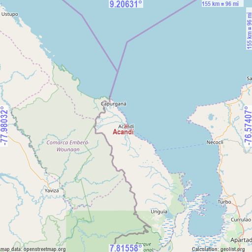
Acandí GPS coordinates[2]
8° 30' 41.688" North, 77° 16' 37.884" West
| Map corner | latitude | longitude |
|---|---|---|
| Upper-left | 9.20631°, | -77.98032° |
| Center: | 8.51158°, | -77.27719° |
| Lower-right: | 7.81558°, | -76.57407° |
| Map W x H: | 154.6×154.6 km | = 96.1×96.1mi |
| max Lat: | 13.38166° ⇑16.1% North |
| Acandí: | 8.51158° |
| min Lat: | ⇓83.9% South -4.21528° |
| min Long | Acandí | max Long |
| -81.70636° | -77.27719° | -67.06996° |
| W 5.4%⇐ | ⇒94.6% E |
Elevation
Elevation of Acandí is 9 m = 30 ft, and this is 1140.3 m = 3741 ft below average elevation for this country.
| Max E: |
3342 m = 10965 ft | 97.1% |
| Avg. | 1149.3 m = 3771 ft | |
| Acandí | 9 m = 30 ft | |
Min E: |
1 m = 3 ft | 2.9% |
See also: Colombia elevation on elevation.city.
Geographical zone
Acandí is located in North Torrid zone (between Equator and Tropic of Cancer). Distance of Equator is 946.4 km =588.1 mi to South.| Distance of | km | miles | from Acandí |
|---|---|---|---|
| North Pole | 9060.7 | 5630.1 | to North |
| Arctic Circle | 6454.8 | 4010.8 | to North |
| Tropic Cancer | 1659.5 | 1031.2 | to North |
| Equator | 946.4 | 588.1 | to South |


Nearby cities:
15 places around Acandí: (largest is in red/bold)
• Apartadó
100.1 km =62.2 mi,  134°
134°
• Arboletes
100.8 km =62.6 mi,  68°
68°
• Canalete
117.9 km =73.3 mi,  75°
75°
• Canalete
119.4 km =74.2 mi, 81°
• Carepa
108.3 km =67.3 mi,  140°
140°
• Chigorodó
114.6 km =71.2 mi,  145°
145°
• Los Córdobas
110 km =68.4 mi, 67°
• Necoclí
54.5 km =33.9 mi,  100°
100°
• Puerto Escondido
124.8 km =77.5 mi,  63°
63°
• Riosucio
120 km =74.6 mi,  171°
171°
• San Juan de Urabá
86.7 km =53.9 mi, 71°
• San Pedro de Urabá
102.5 km =63.7 mi, 104°
• Turbo
76.3 km =47.4 mi, 127°
• Unguía
55.9 km =34.7 mi,  158°
158°
• Valencia
127.2 km =79 mi, 102°
Sources, notices
• [Note1] Compared only with cities in Colombia existing in our database
• [Src1] Map data: © OpenStreetMap contributors (CC-BY-SA)
• [Src2] Other city data from geonames.org with taken over terms of usage.
• [Src3] Geographical zone / Annual Mean Temperature by Robert A. Rohde @ Wikipedia
