San Pedro de Urabá geodata
San Pedro de Urabá (Antioquia) is a seat of a second-order administrative division; located in Colombia in America/Bogota (GMT-5) time zone. With population of 11,095 people, there are 278 cities with bigger population in this country. Compared to other cities in Colombia, 82.3% of cities are located further ↓South; 85.3% of cities are located further →East and 78% of cities have higher elevation than San Pedro de Urabá. Note1


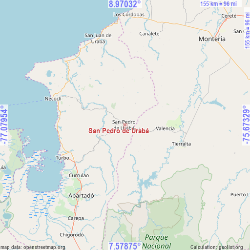
San Pedro de Urabá GPS coordinates[2]
8° 16' 30.54" North, 76° 22' 35.076" West
| Map corner | latitude | longitude |
|---|---|---|
| Upper-left | 8.97032°, | -77.07954° |
| Center: | 8.27515°, | -76.37641° |
| Lower-right: | 7.57875°, | -75.67329° |
| Map W x H: | 154.7×154.7 km | = 96.1×96.1mi |
| max Lat: | 13.38166° ⇑17.7% North |
| San Pedro de Urabá: | 8.27515° |
| min Lat: | ⇓82.3% South -4.21528° |
| min Long | San Pedro de Ur | max Long |
| -81.70636° | -76.37641° | -67.06996° |
| W 14.7%⇐ | ⇒85.3% E |
Elevation
Elevation of San Pedro de Urabá is 141 m = 463 ft, and this is 1008.3 m = 3308 ft below average elevation for this country.
| Max E: |
3342 m = 10965 ft | 78% |
| Avg. | 1149.3 m = 3771 ft | |
| San Pedro de Urabá | 141 m = 463 ft | |
Min E: |
1 m = 3 ft | 22% |
See also: Colombia elevation on elevation.city.
Geographical zone
San Pedro de Urabá is located in North Torrid zone (between Equator and Tropic of Cancer). Distance of Equator is 920.1 km =571.7 mi to South.| Distance of | km | miles | from San Pedro de Urabá |
|---|---|---|---|
| North Pole | 9087 | 5646.4 | to North |
| Arctic Circle | 6481.1 | 4027.2 | to North |
| Tropic Cancer | 1685.8 | 1047.5 | to North |
| Equator | 920.1 | 571.7 | to South |


Nearby cities:
15 places around San Pedro de Urabá: (largest is in red/bold)
• Apartadó
51.5 km =32 mi,  212°
212°
• Arboletes
64.2 km =39.9 mi,  355°
355°
• Canalete
48.4 km =30.1 mi,  23°
23°
• Canalete
58.7 km =36.5 mi,  14°
14°
• Carepa
65 km =40.4 mi, 207°
• Chigorodó
75.5 km =46.9 mi, 206°
• Los Córdobas
68.9 km =42.8 mi,  2°
2°
• Montería
75.7 km =47 mi,  45°
45°
• Moñitos
36 km =22.4 mi,  94°
94°
• Necoclí
48.4 km =30.1 mi,  290°
290°
• San Juan de Urabá
56.4 km =35 mi,  342°
342°
• Tierralta
36.7 km =22.8 mi,  107°
107°
• Turbo
43.7 km =27.2 mi,  242°
242°
• Unguía
82.8 km =51.4 mi,  251°
251°
• Valencia
25.1 km =15.6 mi, 94°
Sources, notices
• [Note1] Compared only with cities in Colombia existing in our database
• [Src1] Map data: © OpenStreetMap contributors (CC-BY-SA)
• [Src2] Other city data from geonames.org with taken over terms of usage.
• [Src3] Geographical zone / Annual Mean Temperature by Robert A. Rohde @ Wikipedia
