Santa Cruz geodata
Santa Cruz (Guanacaste) is a populated place; located in Costa Rica in America/Costa_Rica (GMT-6) time zone. With population of 12,281 people, there are 46 cities with bigger population in this country. Compared to other cities in Costa Rica, 84.3% of cities are located further ↓South; 97.8% of cities are located further →East and 83.6% of cities have higher elevation than Santa Cruz. Note1


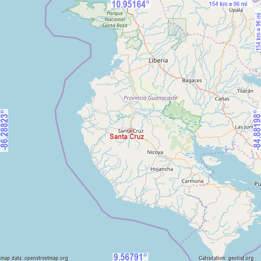
Santa Cruz GPS coordinates[2]
10° 15' 37.908" North, 85° 35' 6.36" West
| Map corner | latitude | longitude |
|---|---|---|
| Upper-left | 10.95164°, | -86.28823° |
| Center: | 10.26053°, | -85.5851° |
| Lower-right: | 9.56791°, | -84.88198° |
| Map W x H: | 153.9×153.9 km | = 95.6×95.6mi |
| max Lat: | 11.07377° ⇑15.7% North |
| Santa Cruz: | 10.26053° |
| min Lat: | ⇓84.3% South 8.53305° |
| min Long | Santa Cruz | max Long |
| -85.64748° | -85.5851° | -82.62185° |
| W 2.2%⇐ | ⇒97.8% E |
Elevation
Elevation of Santa Cruz is 58 m = 190 ft, and this is 677 m = 2221 ft below average elevation for this country.
| Max E: |
1844 m = 6050 ft | 83.6% |
| Avg. | 735 m = 2411 ft | |
| Santa Cruz | 58 m = 190 ft | |
Min E: |
7 m = 23 ft | 16.4% |
See also: Costa Rica elevation on elevation.city.
Geographical zone
Santa Cruz is located in North Torrid zone (between Equator and Tropic of Cancer). Distance of Equator is 1140.9 km =708.9 mi to South.| Distance of | km | miles | from Santa Cruz |
|---|---|---|---|
| North Pole | 8866.2 | 5509.2 | to North |
| Arctic Circle | 6260.3 | 3890 | to North |
| Tropic Cancer | 1465.1 | 910.4 | to North |
| Equator | 1140.9 | 708.9 | to South |


Nearby cities:
15 places around Santa Cruz: (largest is in red/bold)
• Bagaces
46.6 km =29 mi,  50°
50°
• Bejuco
53.5 km =33.2 mi,  148°
148°
• Belén
16.4 km =10.2 mi,  358°
358°
• Bijagua
78.1 km =48.5 mi, 47°
• Cañas
56.5 km =35.1 mi,  70°
70°
• Fortuna
62.3 km =38.7 mi,  42°
42°
• Hojancha
29 km =18 mi,  140°
140°
• Juntas
68.5 km =42.6 mi,  88°
88°
• Liberia
44.7 km =27.8 mi,  21°
21°
• Nandayure
49.1 km =30.5 mi,  120°
120°
• Nicoya
19.1 km =11.9 mi,  129°
129°
• Sardinal
29.3 km =18.2 mi,  346°
346°
• Sámara
42.6 km =26.5 mi,  171°
171°
• Tilarán
71.3 km =44.3 mi, 71°
• Zapotal
42.6 km =26.5 mi, 132°
Sources, notices
• [Note1] Compared only with cities in Costa Rica existing in our database
• [Src1] Map data: © OpenStreetMap contributors (CC-BY-SA)
• [Src2] Other city data from geonames.org with taken over terms of usage.
• [Src3] Geographical zone / Annual Mean Temperature by Robert A. Rohde @ Wikipedia
