Liberia geodata
Liberia (Guanacaste) is a seat of a first-order administrative division; located in Costa Rica in America/Costa_Rica (GMT-6) time zone. With population of 45,380 people, there are 4 cities with bigger population in this country. Compared to other cities in Costa Rica, 95.5% of cities are located further ↓South; 95.5% of cities are located further →East and 75.4% of cities have higher elevation than Liberia. Note1


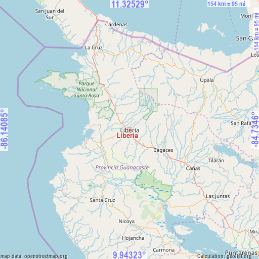
Liberia GPS coordinates[2]
10° 38' 6.144" North, 85° 26' 15.792" West
| Map corner | latitude | longitude |
|---|---|---|
| Upper-left | 11.32529°, | -86.14085° |
| Center: | 10.63504°, | -85.43772° |
| Lower-right: | 9.94323°, | -84.7346° |
| Map W x H: | 153.7×153.7 km | = 95.5×95.5mi |
| max Lat: | 11.07377° ⇑4.5% North |
| Liberia: | 10.63504° |
| min Lat: | ⇓95.5% South 8.53305° |
| min Long | Liberia | max Long |
| -85.64748° | -85.43772° | -82.62185° |
| W 4.5%⇐ | ⇒95.5% E |
Elevation
Elevation of Liberia is 148 m = 486 ft, and this is 587 m = 1926 ft below average elevation for this country.
| Max E: |
1844 m = 6050 ft | 75.4% |
| Avg. | 735 m = 2411 ft | |
| Liberia | 148 m = 486 ft | |
Min E: |
7 m = 23 ft | 24.6% |
See also: Liberia elevation on elevation.city.
Geographical zone
Liberia is located in North Torrid zone (between Equator and Tropic of Cancer). Distance of Equator is 1182.5 km =734.8 mi to South.| Distance of | km | miles | from Liberia |
|---|---|---|---|
| North Pole | 8824.6 | 5483.4 | to North |
| Arctic Circle | 6218.7 | 3864.1 | to North |
| Tropic Cancer | 1423.4 | 884.5 | to North |
| Equator | 1182.5 | 734.8 | to South |


Nearby cities:
15 places around Liberia: (largest is in red/bold)
• Bagaces
23.4 km =14.5 mi,  121°
121°
• Belén
30.2 km =18.8 mi,  213°
213°
• Bijagua
43 km =26.7 mi,  75°
75°
• Cañas
43.5 km =27 mi, 121°
• Fortuna
26.3 km =16.3 mi, 80°
• Hojancha
64.2 km =39.9 mi,  178°
178°
• Juntas
65.5 km =40.7 mi,  126°
126°
• La Cruz
53.2 km =33.1 mi,  336°
336°
• Nandayure
71.8 km =44.6 mi,  158°
158°
• Nicoya
53.9 km =33.5 mi, 181°
• San José
48.2 km =30 mi,  43°
43°
• Santa Cruz
44.7 km =27.8 mi,  201°
201°
• Sardinal
26.4 km =16.4 mi,  240°
240°
• Tilarán
54.7 km =34 mi,  109°
109°
• Upala
54.7 km =34 mi,  57°
57°
Sources, notices
• [Note1] Compared only with cities in Costa Rica existing in our database
• [Src1] Map data: © OpenStreetMap contributors (CC-BY-SA)
• [Src2] Other city data from geonames.org with taken over terms of usage.
• [Src3] Geographical zone / Annual Mean Temperature by Robert A. Rohde @ Wikipedia
