Río Segundo geodata
Río Segundo (Alajuela) is a populated place; located in Costa Rica in America/Costa_Rica (GMT-6) time zone. With population of 9,853 people, there are 55 cities with bigger population in this country. Compared to other cities in Costa Rica, 83.6% of cities are located further ↓South; 64.9% of cities are located further →East and 85.8% of cities have lower elevation than Río Segundo. Note1


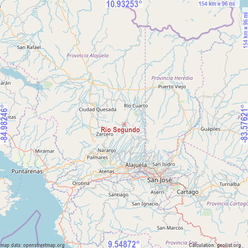
Río Segundo GPS coordinates[2]
10° 14' 28.968" North, 84° 16' 45.588" West
| Map corner | latitude | longitude |
|---|---|---|
| Upper-left | 10.93253°, | -84.98246° |
| Center: | 10.24138°, | -84.27933° |
| Lower-right: | 9.54872°, | -83.57621° |
| Map W x H: | 153.9×153.9 km | = 95.6×95.6mi |
| max Lat: | 11.07377° ⇑16.4% North |
| Río Segundo: | 10.24138° |
| min Lat: | ⇓83.6% South 8.53305° |
| min Long | Río Segundo | max Long |
| -85.64748° | -84.27933° | -82.62185° |
| W 35.1%⇐ | ⇒64.9% E |
Elevation
Elevation of Río Segundo is 1275 m = 4183 ft, and this is 540 m = 1772 ft above average elevation for this country.
| Max E: |
1844 m = 6050 ft | 14.2% |
| Río Segundo | 1275 m 4183 ft | |
| Avg. | 735 m = 2411 ft | |
Min E: |
7 m = 23 ft | 85.8% |
See also: Costa Rica elevation on elevation.city.
Geographical zone
Río Segundo is located in North Torrid zone (between Equator and Tropic of Cancer). Distance of Equator is 1138.7 km =707.6 mi to South.| Distance of | km | miles | from Río Segundo |
|---|---|---|---|
| North Pole | 8868.3 | 5510.5 | to North |
| Arctic Circle | 6262.4 | 3891.3 | to North |
| Tropic Cancer | 1467.2 | 911.7 | to North |
| Equator | 1138.7 | 707.6 | to South |


Nearby cities:
15 places around Río Segundo: (largest is in red/bold)
• Alajuela
26.1 km =16.2 mi,  163°
163°
• Carrillos
23.6 km =14.7 mi,  178°
178°
• Esquipulas
25.9 km =16.1 mi,  217°
217°
• Florencia
25.2 km =15.7 mi,  301°
301°
• La Virgen
23.9 km =14.9 mi,  41°
41°
• Laguna
13.7 km =8.5 mi,  255°
255°
• Naranjo
19.2 km =11.9 mi,  214°
214°
• Pital
23.3 km =14.5 mi,  1°
1°
• Quesada
18.6 km =11.6 mi, 299°
• Sabanilla
19.9 km =12.4 mi, 159°
• San Juan
16 km =9.9 mi,  194°
194°
• San Ramón
27 km =16.8 mi,  230°
230°
• Santo Domingo
24 km =14.9 mi,  145°
145°
• Sarchí
18.4 km =11.4 mi,  203°
203°
• Zarcero
13.7 km =8.5 mi,  243°
243°
Sources, notices
• [Note1] Compared only with cities in Costa Rica existing in our database
• [Src1] Map data: © OpenStreetMap contributors (CC-BY-SA)
• [Src2] Other city data from geonames.org with taken over terms of usage.
• [Src3] Geographical zone / Annual Mean Temperature by Robert A. Rohde @ Wikipedia
