Zarcero geodata
Zarcero (Alajuela) is a populated place; located in Costa Rica in America/Costa_Rica (GMT-6) time zone. With population of 3,559 people, there are 91 cities with bigger population in this country. Compared to other cities in Costa Rica, 80.6% of cities are located further ↓South; 70.9% of cities are located further →East and 98.5% of cities have lower elevation than Zarcero. Note1


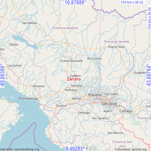
Zarcero GPS coordinates[2]
10° 11' 8.196" North, 84° 23' 26.736" West
| Map corner | latitude | longitude |
|---|---|---|
| Upper-left | 10.87689°, | -85.09389° |
| Center: | 10.18561°, | -84.39076° |
| Lower-right: | 9.49283°, | -83.68764° |
| Map W x H: | 153.9×153.9 km | = 95.6×95.6mi |
| max Lat: | 11.07377° ⇑19.4% North |
| Zarcero: | 10.18561° |
| min Lat: | ⇓80.6% South 8.53305° |
| min Long | Zarcero | max Long |
| -85.64748° | -84.39076° | -82.62185° |
| W 29.1%⇐ | ⇒70.9% E |
Elevation
Elevation of Zarcero is 1752 m = 5748 ft, and this is 1017 m = 3337 ft above average elevation for this country.
| Max E: |
1844 m = 6050 ft | 1.5% |
| Zarcero | 1752 m 5748 ft | |
| Avg. | 735 m = 2411 ft | |
Min E: |
7 m = 23 ft | 98.5% |
See also: Costa Rica elevation on elevation.city.
Geographical zone
Zarcero is located in North Torrid zone (between Equator and Tropic of Cancer). Distance of Equator is 1132.5 km =703.7 mi to South.| Distance of | km | miles | from Zarcero |
|---|---|---|---|
| North Pole | 8874.5 | 5514.4 | to North |
| Arctic Circle | 6268.6 | 3895.1 | to North |
| Tropic Cancer | 1473.4 | 915.5 | to North |
| Equator | 1132.5 | 703.7 | to South |


Nearby cities:
15 places around Zarcero: (largest is in red/bold)
• Atenas
23.5 km =14.6 mi,  176°
176°
• Barrio Jesús
23.7 km =14.7 mi,  188°
188°
• Carrillos
21.6 km =13.4 mi,  143°
143°
• Esquipulas
14.8 km =9.2 mi, 193°
• Florencia
21.6 km =13.4 mi,  334°
334°
• Laguna
2.9 km =1.8 mi,  337°
337°
• Naranjo
9.8 km =6.1 mi,  171°
171°
• Quesada
15.9 km =9.9 mi,  345°
345°
• Río Segundo
13.7 km =8.5 mi,  63°
63°
• Sabanilla
22.8 km =14.2 mi,  122°
122°
• San Juan
12.3 km =7.6 mi, 138°
• San Rafael
16.2 km =10.1 mi,  213°
213°
• San Ramón
13.9 km =8.6 mi,  218°
218°
• Santiago
19 km =11.8 mi,  197°
197°
• Sarchí
11.7 km =7.3 mi,  156°
156°
Sources, notices
• [Note1] Compared only with cities in Costa Rica existing in our database
• [Src1] Map data: © OpenStreetMap contributors (CC-BY-SA)
• [Src2] Other city data from geonames.org with taken over terms of usage.
• [Src3] Geographical zone / Annual Mean Temperature by Robert A. Rohde @ Wikipedia
