La Suiza geodata
La Suiza (Cartago) is a populated place; located in Costa Rica in America/Costa_Rica (GMT-6) time zone. With population of 2,434 people, there are 100 cities with bigger population in this country. Compared to other cities in Costa Rica, 77.6% of cities are located further ↑North; 88.1% of cities are located further ←West and 59% of cities have higher elevation than La Suiza. Note1


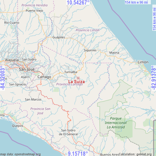
La Suiza GPS coordinates[2]
9° 51' 2.34" North, 83° 37' 0.84" West
| Map corner | latitude | longitude |
|---|---|---|
| Upper-left | 10.54267°, | -84.32003° |
| Center: | 9.85065°, | -83.6169° |
| Lower-right: | 9.15718°, | -82.91378° |
| Map W x H: | 154.1×154.1 km | = 95.8×95.8mi |
| max Lat: | 11.07377° ⇑77.6% North |
| La Suiza: | 9.85065° |
| min Lat: | ⇓22.4% South 8.53305° |
| min Long | La Suiza | max Long |
| -85.64748° | -83.6169° | -82.62185° |
| W 88.1%⇐ | ⇒11.9% E |
Elevation
Elevation of La Suiza is 611 m = 2005 ft, and this is 124 m = 407 ft below average elevation for this country.
| Max E: |
1844 m = 6050 ft | 59% |
| Avg. | 735 m = 2411 ft | |
| La Suiza | 611 m = 2005 ft | |
Min E: |
7 m = 23 ft | 41% |
See also: Costa Rica elevation on elevation.city.
Geographical zone
La Suiza is located in North Torrid zone (between Equator and Tropic of Cancer). Distance of Equator is 1095.3 km =680.6 mi to South.| Distance of | km | miles | from La Suiza |
|---|---|---|---|
| North Pole | 8911.8 | 5537.5 | to North |
| Arctic Circle | 6305.9 | 3918.3 | to North |
| Tropic Cancer | 1510.6 | 938.6 | to North |
| Equator | 1095.3 | 680.6 | to South |


Nearby cities:
15 places around La Suiza: (largest is in red/bold)
• Batán
40.4 km =25.1 mi,  50°
50°
• Capellades
20 km =12.4 mi,  293°
293°
• Cartago
33.2 km =20.6 mi,  272°
272°
• Cot
28.5 km =17.7 mi,  279°
279°
• Guácimo
41 km =25.5 mi,  349°
349°
• Jiménez
39.2 km =24.4 mi,  333°
333°
• Orosí
26.7 km =16.6 mi,  256°
256°
• Pacuarito
32.2 km =20 mi,  29°
29°
• Paraíso
27.3 km =17 mi, 267°
• Pejibaye
10.4 km =6.5 mi,  245°
245°
• Pocora
35.7 km =22.2 mi,  2°
2°
• Siquirres
30 km =18.6 mi,  23°
23°
• Tobosi
40.2 km =25 mi, 268°
• Tucurrique
11.6 km =7.2 mi, 271°
• Turrialba
9.5 km =5.9 mi,  309°
309°
Sources, notices
• [Note1] Compared only with cities in Costa Rica existing in our database
• [Src1] Map data: © OpenStreetMap contributors (CC-BY-SA)
• [Src2] Other city data from geonames.org with taken over terms of usage.
• [Src3] Geographical zone / Annual Mean Temperature by Robert A. Rohde @ Wikipedia
