Capellades geodata
Capellades (Cartago) is a populated place; located in Costa Rica in America/Costa_Rica (GMT-6) time zone. With population of 993 people, there are 118 cities with bigger population in this country. Compared to other cities in Costa Rica, 61.9% of cities are located further ↑North; 79.9% of cities are located further ←West and 97% of cities have lower elevation than Capellades. Note1


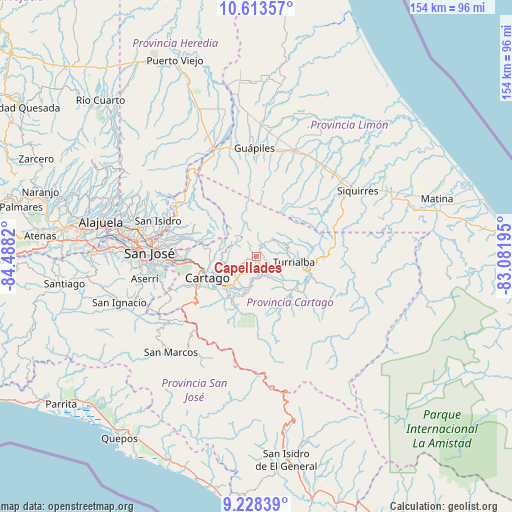
Capellades GPS coordinates[2]
9° 55' 18.156" North, 83° 47' 6.252" West
| Map corner | latitude | longitude |
|---|---|---|
| Upper-left | 10.61357°, | -84.4882° |
| Center: | 9.92171°, | -83.78507° |
| Lower-right: | 9.22839°, | -83.08195° |
| Map W x H: | 154×154 km | = 95.7×95.7mi |
| max Lat: | 11.07377° ⇑61.9% North |
| Capellades: | 9.92171° |
| min Lat: | ⇓38.1% South 8.53305° |
| min Long | Capellades | max Long |
| -85.64748° | -83.78507° | -82.62185° |
| W 79.9%⇐ | ⇒20.1% E |
Elevation
Elevation of Capellades is 1644 m = 5394 ft, and this is 909 m = 2982 ft above average elevation for this country.
| Max E: |
1844 m = 6050 ft | 3% |
| Capellades | 1644 m 5394 ft | |
| Avg. | 735 m = 2411 ft | |
Min E: |
7 m = 23 ft | 97% |
See also: Costa Rica elevation on elevation.city.
Geographical zone
Capellades is located in North Torrid zone (between Equator and Tropic of Cancer). Distance of Equator is 1103.2 km =685.5 mi to South.| Distance of | km | miles | from Capellades |
|---|---|---|---|
| North Pole | 8903.9 | 5532.6 | to North |
| Arctic Circle | 6298 | 3913.4 | to North |
| Tropic Cancer | 1502.7 | 933.7 | to North |
| Equator | 1103.2 | 685.5 | to South |


Nearby cities:
15 places around Capellades: (largest is in red/bold)
• Cartago
16 km =9.9 mi,  246°
246°
• Concepción
23.6 km =14.7 mi,  273°
273°
• Cot
10.1 km =6.3 mi, 252°
• Granadilla
25.4 km =15.8 mi, 273°
• Ipís
25.5 km =15.8 mi,  281°
281°
• La Suiza
20 km =12.4 mi,  113°
113°
• Orosí
15.9 km =9.9 mi,  208°
208°
• Paraíso
12.8 km =8 mi,  223°
223°
• Pejibaye
15.2 km =9.4 mi,  143°
143°
• Purral
27.2 km =16.9 mi, 278°
• San Diego
24 km =14.9 mi,  263°
263°
• Tobosi
23.7 km =14.7 mi, 246°
• Tres Ríos
22.2 km =13.8 mi, 265°
• Tucurrique
10.2 km =6.3 mi, 138°
• Turrialba
11.3 km =7 mi,  99°
99°
Sources, notices
• [Note1] Compared only with cities in Costa Rica existing in our database
• [Src1] Map data: © OpenStreetMap contributors (CC-BY-SA)
• [Src2] Other city data from geonames.org with taken over terms of usage.
• [Src3] Geographical zone / Annual Mean Temperature by Robert A. Rohde @ Wikipedia
