Isabela de Sagua geodata
Isabela de Sagua (Villa Clara) is a populated place; located in Cuba in America/Havana (GMT-4) time zone. With population of 3,187 people, there are 151 cities with bigger population in this country. Compared to other cities in Cuba, 85.1% of cities are located further ↓South; 51.9% of cities are located further →East and 98.9% of cities have higher elevation than Isabela de Sagua. Note1


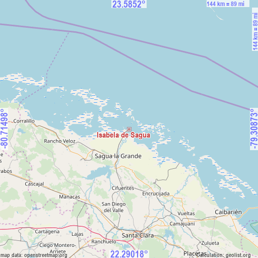
Isabela de Sagua GPS coordinates[2]
22° 56' 21.264" North, 80° 0' 42.66" West
| Map corner | latitude | longitude |
|---|---|---|
| Upper-left | 23.5852°, | -80.71498° |
| Center: | 22.93924°, | -80.01185° |
| Lower-right: | 22.29018°, | -79.30873° |
| Map W x H: | 144×144 km | = 89.5×89.5mi |
| max Lat: | 23.15917° ⇑14.9% North |
| Isabela de Sagua: | 22.93924° |
| min Lat: | ⇓85.1% South 19.90553° |
| min Long | Isabela de Sagu | max Long |
| -84.28599° | -80.01185° | -74.15181° |
| W 48.1%⇐ | ⇒51.9% E |
Elevation
Elevation of Isabela de Sagua is 5 m = 16 ft, and this is 63.6 m = 209 ft below average elevation for this country.
| Max E: |
761 m = 2497 ft | 98.9% |
| Avg. | 68.6 m = 225 ft | |
| Isabela de Sagua | 5 m = 16 ft | |
Min E: |
3 m = 10 ft | 1.1% |
See also: Cuba elevation on elevation.city.
Geographical zone
Isabela de Sagua is located in North Torrid zone (between Equator and Tropic of Cancer). Distance of this Northern Tropic circle is 55.3 km =34.4 mi to North.| Distance of | km | miles | from Isabela de Sagua |
|---|---|---|---|
| North Pole | 7456.5 | 4633.3 | to North |
| Arctic Circle | 4850.6 | 3014 | to North |
| Tropic Cancer | 55.3 | 34.4 | to North |
| Equator | 2550.6 | 1584.9 | to South |


Nearby cities:
15 places around Isabela de Sagua: (largest is in red/bold)
• Calabazar de Sagua
34.8 km =21.6 mi,  159°
159°
• Camajuaní
57.4 km =35.7 mi,  152°
152°
• Camajuaní
60.5 km =37.6 mi, 150°
• Cifuentes
32.5 km =20.2 mi,  186°
186°
• Corralillo
58.9 km =36.6 mi,  274°
274°
• Encrucijada
38.7 km =24 mi, 157°
• Esperanza
55.4 km =34.4 mi, 189°
• Lajas
65.1 km =40.5 mi,  206°
206°
• Quemado de Güines
29.8 km =18.5 mi,  235°
235°
• Rancho Veloz
39.4 km =24.5 mi,  260°
260°
• Ranchuelo
64.6 km =40.1 mi, 192°
• Remedios
68.8 km =42.8 mi,  135°
135°
• Sagua la Grande
16.1 km =10 mi,  203°
203°
• Santa Clara
59.4 km =36.9 mi,  175°
175°
• Santo Domingo
45.8 km =28.5 mi, 211°
Sources, notices
• [Note1] Compared only with cities in Cuba existing in our database
• [Src1] Map data: © OpenStreetMap contributors (CC-BY-SA)
• [Src2] Other city data from geonames.org with taken over terms of usage.
• [Src3] Geographical zone / Annual Mean Temperature by Robert A. Rohde @ Wikipedia
