João Teves geodata
João Teves (São Lourenço dos Órgãos) is a seat of a first-order administrative division; located in Cape Verde in Atlantic/Cape_Verde (GMT-1) time zone. In our database, there are 24 cities with bigger population. Compared to other cities in Cape Verde, 70.8% of cities are located further ↑North; 66.7% of cities are located further ←West and 83.3% of cities have lower elevation than João Teves. Note1


João Teves GPS coordinates[2]
15° 4' 0.984" North, 23° 35' 21.012" West
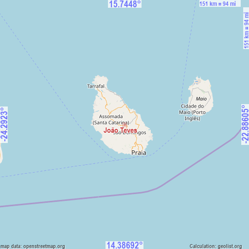
| Map corner | latitude | longitude |
|---|---|---|
| Upper-left | 15.7448°, | -24.2923° |
| Center: | 15.06694°, | -23.58917° |
| Lower-right: | 14.38692°, | -22.88605° |
| Map W x H: | 151×151 km | = 93.8×93.8mi |
| max Lat: | 17.20171° ⇑70.8% North |
| João Teves: | 15.06694° |
| min Lat: | ⇓29.2% South 14.87139° |
| min Long | João Teves | max Long |
| -25.09217° | -23.58917° | -22.90509° |
| W 66.7%⇐ | ⇒33.3% E |
Elevation
Elevation of João Teves is 299 m = 981 ft, and this is 181.2 m = 594 ft above average elevation for this country.
| Max E: |
480 m = 1575 ft | 16.7% |
| João Teves | 299 m 981 ft | |
| Avg. | 117.8 m = 386 ft | |
Min E: |
1 m = 3 ft | 83.3% |
See also: Cape Verde elevation on elevation.city.
Geographical zone
João Teves is located in North Torrid zone (between Equator and Tropic of Cancer). Distance of this Northern Tropic circle is 930.6 km =578.2 mi to North.| Distance of | km | miles | from João Teves |
|---|---|---|---|
| North Pole | 8331.8 | 5177.1 | to North |
| Arctic Circle | 5725.9 | 3557.9 | to North |
| Tropic Cancer | 930.6 | 578.2 | to North |
| Equator | 1675.3 | 1041 | to South |


Nearby cities:
15 places around João Teves: (largest is in red/bold)
• Assomada
10.8 km =6.7 mi,  289°
289°
• Calheta
13.3 km =8.3 mi,  358°
358°
• Cidade Velha
16.9 km =10.5 mi,  185°
185°
• Cova Figueira
78.1 km =48.5 mi,  255°
255°
• Igreja
79.1 km =49.2 mi,  267°
267°
• Nova Sintra
120.8 km =75.1 mi, 259°
• Pedra Badejo
10 km =6.2 mi,  38°
38°
• Picos
5 km =3.1 mi, 291°
• Praia
17.2 km =10.7 mi,  151°
151°
• Sal Rei
142.8 km =88.7 mi,  30°
30°
• Santa Cruz
7.8 km =4.8 mi,  18°
18°
• São Domingos
5.5 km =3.4 mi, 148°
• São Filipe
99.2 km =61.6 mi, 258°
• Tarrafal
29.3 km =18.2 mi,  323°
323°
• Vila do Maio
41.3 km =25.7 mi,  78°
78°
Sources, notices
• [Note1] Compared only with cities in Cape Verde existing in our database
• [Src1] Map data: © OpenStreetMap contributors (CC-BY-SA)
• [Src2] Other city data from geonames.org with taken over terms of usage.
• [Src3] Geographical zone / Annual Mean Temperature by Robert A. Rohde @ Wikipedia
