Wrestedt geodata
Wrestedt (Lower Saxony) is a populated place; located in Germany in Europe/Berlin (GMT+2) time zone. With population of 2,996 people, there are 4002 cities with bigger population in this country. Compared to other cities in Germany, 81.1% of cities are located further ↓South; 60.3% of cities are located further ←West and 79.4% of cities have higher elevation than Wrestedt. Note1


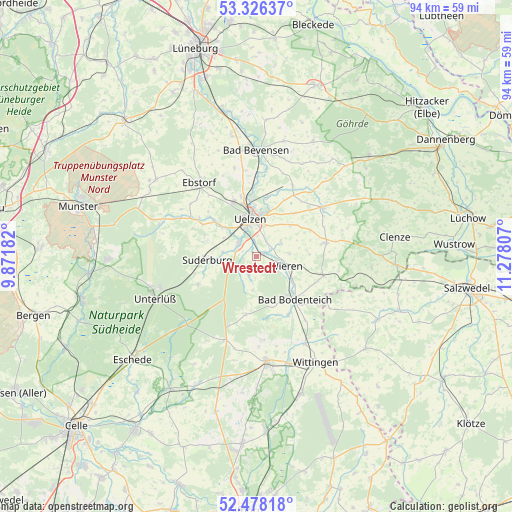
Wrestedt GPS coordinates[2]
52° 54' 15.66" North, 10° 34' 29.784" East
| Map corner | latitude | longitude |
|---|---|---|
| Upper-left | 53.32637°, | 9.87182° |
| Center: | 52.90435°, | 10.57494° |
| Lower-right: | 52.47818°, | 11.27807° |
| Map W x H: | 94.3×94.3 km | = 58.6×58.6mi |
| max Lat: | 55.01917° ⇑18.9% North |
| Wrestedt: | 52.90435° |
| min Lat: | ⇓81.1% South 47.40724° |
| min Long | Wrestedt | max Long |
| 5.92978° | 10.57494° | 14.98853° |
| W 60.3%⇐ | ⇒39.7% E |
Elevation
Elevation of Wrestedt is 48 m = 157 ft, and this is 201.1 m = 660 ft below average elevation for this country.
| Max E: |
1256 m = 4121 ft | 79.4% |
| Avg. | 249.1 m = 817 ft | |
| Wrestedt | 48 m = 157 ft | |
Min E: |
-5 m = -16 ft | 20.6% |
See also: Germany elevation on elevation.city.
Geographical zone
Wrestedt is located in North temperate zone (between Tropic of Cancer and the Arctic Circle). Distance of this North polar circle is 1518.8 km =943.7 mi to North.| Distance of | km | miles | from Wrestedt |
|---|---|---|---|
| North Pole | 4124.6 | 2562.9 | to North |
| Arctic Circle | 1518.8 | 943.7 | to North |
| Tropic Cancer | 3276.5 | 2035.9 | to South |
| Equator | 5882.4 | 3655.2 | to South |


Nearby cities:
15 places around Wrestedt: (largest is in red/bold)
• Bodenteich
10.9 km =6.8 mi,  138°
138°
• Emmendorf
12.9 km =8 mi,  356°
356°
• Gerdau
12.7 km =7.9 mi,  303°
303°
• Lüder
12.3 km =7.6 mi,  150°
150°
• Obernholz
15.4 km =9.6 mi,  174°
174°
• Oetzen
14.4 km =8.9 mi,  27°
27°
• Rosche
15 km =9.3 mi,  52°
52°
• Rätzlingen
10.4 km =6.5 mi,  40°
40°
• Schwienau
14.2 km =8.8 mi,  322°
322°
• Soltendieck
13 km =8.1 mi,  105°
105°
• Stadensen
3.4 km =2.1 mi,  201°
201°
• Suderburg
8.3 km =5.2 mi,  263°
263°
• Suhlendorf
13.3 km =8.3 mi,  75°
75°
• Uelzen
6.9 km =4.3 mi,  352°
352°
• Wieren
6 km =3.7 mi, 110°
Sources, notices
• [Note1] Compared only with cities in Germany existing in our database
• [Src1] Map data: © OpenStreetMap contributors (CC-BY-SA)
• [Src2] Other city data from geonames.org with taken over terms of usage.
• [Src3] Geographical zone / Annual Mean Temperature by Robert A. Rohde @ Wikipedia
