Trusetal geodata
Trusetal (Thuringia) is a seat of a fourth-order administrative division; located in Germany in Europe/Berlin (GMT+2) time zone. With population of 4,208 people, there are 3172 cities with bigger population in this country. Compared to other cities in Germany, 53.8% of cities are located further ↓South; 57.3% of cities are located further ←West and 76.1% of cities have lower elevation than Trusetal. Note1
Administrative division(s):
- Level 1: Thuringia
- Level 3: Landkreis Schmalkalden-Meiningen
- Level 4: Trusetal


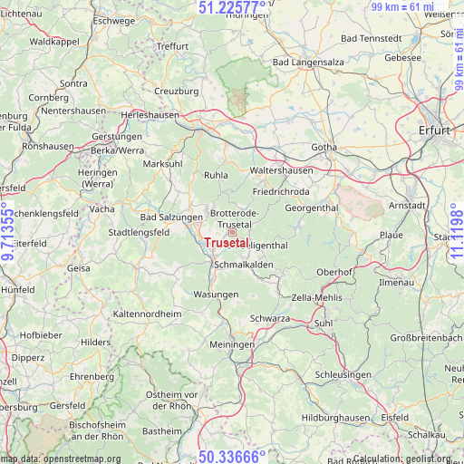
Trusetal GPS coordinates[2]
50° 46' 59.988" North, 10° 25' 0.012" East
| Map corner | latitude | longitude |
|---|---|---|
| Upper-left | 51.22577°, | 9.71355° |
| Center: | 50.78333°, | 10.41667° |
| Lower-right: | 50.33666°, | 11.1198° |
| Map W x H: | 98.9×98.9 km | = 61.5×61.5mi |
| max Lat: | 55.01917° ⇑46.2% North |
| Trusetal: | 50.78333° |
| min Lat: | ⇓53.8% South 47.40724° |
| min Long | Trusetal | max Long |
| 5.92978° | 10.41667° | 14.98853° |
| W 57.3%⇐ | ⇒42.7% E |
Elevation
Elevation of Trusetal is 406 m = 1332 ft, and this is 156.9 m = 515 ft above average elevation for this country.
| Max E: |
1256 m = 4121 ft | 23.9% |
| Trusetal | 406 m 1332 ft | |
| Avg. | 249.1 m = 817 ft | |
Min E: |
-5 m = -16 ft | 76.1% |
See also: Germany elevation on elevation.city.
Geographical zone
Trusetal is located in North temperate zone (between Tropic of Cancer and the Arctic Circle). Distance of this North polar circle is 1754.6 km =1090.3 mi to North.| Distance of | km | miles | from Trusetal |
|---|---|---|---|
| North Pole | 4360.5 | 2709.5 | to North |
| Arctic Circle | 1754.6 | 1090.3 | to North |
| Tropic Cancer | 3040.7 | 1889.4 | to South |
| Equator | 5646.6 | 3508.6 | to South |


Nearby cities:
15 places around Trusetal: (largest is in red/bold)
• Altersbach
12.4 km =7.7 mi,  138°
138°
• Bad Liebenstein
5.8 km =3.6 mi,  308°
308°
• Barchfeld
8.4 km =5.2 mi,  282°
282°
• Breitenbach
11.7 km =7.3 mi,  153°
153°
• Breitungen
6.7 km =4.2 mi,  250°
250°
• Brotterode
4.9 km =3 mi,  23°
23°
• Fambach
6.6 km =4.1 mi,  212°
212°
• Immelborn
9.8 km =6.1 mi, 275°
• Pappenheim
4.3 km =2.7 mi,  70°
70°
• Schmalkalden
7.2 km =4.5 mi,  164°
164°
• Schwallungen
10.9 km =6.8 mi,  202°
202°
• Schweina
7.2 km =4.5 mi, 309°
• Steinbach
6.7 km =4.2 mi,  326°
326°
• Tabarz
12.4 km =7.7 mi,  34°
34°
• Wernshausen
8.1 km =5 mi,  215°
215°
Sources, notices
• [Note1] Compared only with cities in Germany existing in our database
• [Src1] Map data: © OpenStreetMap contributors (CC-BY-SA)
• [Src2] Other city data from geonames.org with taken over terms of usage.
• [Src3] Geographical zone / Annual Mean Temperature by Robert A. Rohde @ Wikipedia
