Schäftlarn geodata
Schäftlarn (Bavaria) is a seat of a fourth-order administrative division; located in Germany in Europe/Berlin (GMT+2) time zone. With population of 5,281 people, there are 2707 cities with bigger population in this country. Compared to other cities in Germany, 95.7% of cities are located further ↑North; 73.5% of cities are located further ←West and 96.9% of cities have lower elevation than Schäftlarn. Note1
Administrative division(s):
- Level 1: Bavaria
- Level 2: Upper Bavaria
- Level 3: Landkreis München
- Level 4: Schäftlarn


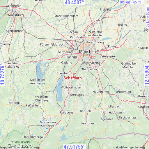
Schäftlarn GPS coordinates[2]
47° 59' 24.972" North, 11° 27' 21.276" East
| Map corner | latitude | longitude |
|---|---|---|
| Upper-left | 48.4587°, | 10.75279° |
| Center: | 47.99027°, | 11.45591° |
| Lower-right: | 47.51755°, | 12.15904° |
| Map W x H: | 104.6×104.6 km | = 65×65mi |
| max Lat: | 55.01917° ⇑95.7% North |
| Schäftlarn: | 47.99027° |
| min Lat: | ⇓4.3% South 47.40724° |
| min Long | Schäftlarn | max Long |
| 5.92978° | 11.45591° | 14.98853° |
| W 73.5%⇐ | ⇒26.5% E |
Elevation
Elevation of Schäftlarn is 658 m = 2159 ft, and this is 408.9 m = 1342 ft above average elevation for this country.
| Max E: |
1256 m = 4121 ft | 3.1% |
| Schäftlarn | 658 m 2159 ft | |
| Avg. | 249.1 m = 817 ft | |
Min E: |
-5 m = -16 ft | 96.9% |
See also: Germany elevation on elevation.city.
Geographical zone
Schäftlarn is located in North temperate zone (between Tropic of Cancer and the Arctic Circle). Distance of this North polar circle is 2065.2 km =1283.3 mi to North.| Distance of | km | miles | from Schäftlarn |
|---|---|---|---|
| North Pole | 4671 | 2902.4 | to North |
| Arctic Circle | 2065.2 | 1283.3 | to North |
| Tropic Cancer | 2730.1 | 1696.4 | to South |
| Equator | 5336 | 3315.6 | to South |


Nearby cities:
15 places around Schäftlarn: (largest is in red/bold)
• Baierbrunn
4.1 km =2.5 mi,  34°
34°
• Berg
8 km =5 mi,  251°
251°
• Egling
8.3 km =5.2 mi,  153°
153°
• Gauting
10.6 km =6.6 mi,  326°
326°
• Grünwald
7.4 km =4.6 mi,  42°
42°
• Icking
4.8 km =3 mi,  200°
200°
• Münsing
12 km =7.5 mi,  213°
213°
• Neuried
11.5 km =7.1 mi,  3°
3°
• Oberhaching
11.2 km =7 mi,  70°
70°
• Pullach im Isartal
9.3 km =5.8 mi, 31°
• Pöcking
11.9 km =7.4 mi,  257°
257°
• Reichertshausen
12.7 km =7.9 mi,  143°
143°
• Starnberg
8.4 km =5.2 mi,  278°
278°
• Straßlach-Dingharting
4.6 km =2.9 mi, 69°
• Wolfratshausen
9 km =5.6 mi, 196°
Sources, notices
• [Note1] Compared only with cities in Germany existing in our database
• [Src1] Map data: © OpenStreetMap contributors (CC-BY-SA)
• [Src2] Other city data from geonames.org with taken over terms of usage.
• [Src3] Geographical zone / Annual Mean Temperature by Robert A. Rohde @ Wikipedia
