Egling geodata
Egling (Bavaria) is a seat of a fourth-order administrative division; located in Germany in Europe/Berlin (GMT+2) time zone. With population of 5,061 people, there are 2804 cities with bigger population in this country. Compared to other cities in Germany, 96.4% of cities are located further ↑North; 74.4% of cities are located further ←West and 95.5% of cities have lower elevation than Egling. Note1
Administrative division(s):
- Level 1: Bavaria
- Level 2: Upper Bavaria
- Level 3: Landkreis Bad Tölz-Wolfratshausen
- Level 4: Egling


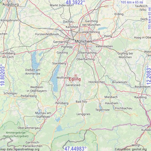
Egling GPS coordinates[2]
47° 55' 23.376" North, 11° 30' 18.612" East
| Map corner | latitude | longitude |
|---|---|---|
| Upper-left | 48.3922°, | 10.80205° |
| Center: | 47.92316°, | 11.50517° |
| Lower-right: | 47.44983°, | 12.2083° |
| Map W x H: | 104.8×104.8 km | = 65.1×65.1mi |
| max Lat: | 55.01917° ⇑96.4% North |
| Egling: | 47.92316° |
| min Lat: | ⇓3.6% South 47.40724° |
| min Long | Egling | max Long |
| 5.92978° | 11.50517° | 14.98853° |
| W 74.4%⇐ | ⇒25.6% E |
Elevation
Elevation of Egling is 611 m = 2005 ft, and this is 361.9 m = 1187 ft above average elevation for this country.
| Max E: |
1256 m = 4121 ft | 4.5% |
| Egling | 611 m 2005 ft | |
| Avg. | 249.1 m = 817 ft | |
Min E: |
-5 m = -16 ft | 95.5% |
See also: Germany elevation on elevation.city.
Geographical zone
Egling is located in North temperate zone (between Tropic of Cancer and the Arctic Circle). Distance of this North polar circle is 2072.6 km =1287.9 mi to North.| Distance of | km | miles | from Egling |
|---|---|---|---|
| North Pole | 4678.5 | 2907.1 | to North |
| Arctic Circle | 2072.6 | 1287.9 | to North |
| Tropic Cancer | 2722.6 | 1691.7 | to South |
| Equator | 5328.6 | 3311 | to South |


Nearby cities:
15 places around Egling: (largest is in red/bold)
• Baierbrunn
10.9 km =6.8 mi,  352°
352°
• Berg
12.3 km =7.6 mi,  293°
293°
• Dietramszell
10.7 km =6.6 mi,  140°
140°
• Eurasburg
10.7 km =6.6 mi,  223°
223°
• Geretsried
7.5 km =4.7 mi,  194°
194°
• Grünwald
13 km =8.1 mi,  5°
5°
• Icking
6.1 km =3.8 mi,  299°
299°
• Königsdorf
12.1 km =7.5 mi, 188°
• Münsing
10.6 km =6.6 mi,  255°
255°
• Otterfing
12.8 km =8 mi,  97°
97°
• Reichertshausen
4.8 km =3 mi,  124°
124°
• Sauerlach
12.3 km =7.6 mi,  64°
64°
• Schäftlarn
8.3 km =5.2 mi,  333°
333°
• Straßlach-Dingharting
9.1 km =5.7 mi,  4°
4°
• Wolfratshausen
6.3 km =3.9 mi, 259°
Sources, notices
• [Note1] Compared only with cities in Germany existing in our database
• [Src1] Map data: © OpenStreetMap contributors (CC-BY-SA)
• [Src2] Other city data from geonames.org with taken over terms of usage.
• [Src3] Geographical zone / Annual Mean Temperature by Robert A. Rohde @ Wikipedia
