Philippsthal geodata
Philippsthal (Hesse) is a populated place; located in Germany in Europe/Berlin (GMT+2) time zone. With population of 4,570 people, there are 2998 cities with bigger population in this country. Compared to other cities in Germany, 55% of cities are located further ↓South; 50.2% of cities are located further ←West and 51.1% of cities have lower elevation than Philippsthal. Note1
Administrative division(s):
- Level 1: Hesse
- Level 2: Regierungsbezirk Kassel
- Level 3: Landkreis Hersfeld-Rotenburg
- Level 4: Philippsthal (Werra)


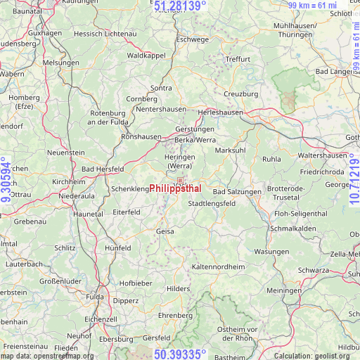
Philippsthal GPS coordinates[2]
50° 50' 22.128" North, 10° 0' 32.616" East
| Map corner | latitude | longitude |
|---|---|---|
| Upper-left | 51.28139°, | 9.30594° |
| Center: | 50.83948°, | 10.00906° |
| Lower-right: | 50.39335°, | 10.71219° |
| Map W x H: | 98.7×98.7 km | = 61.3×61.3mi |
| max Lat: | 55.01917° ⇑45% North |
| Philippsthal: | 50.83948° |
| min Lat: | ⇓55% South 47.40724° |
| min Long | Philippsthal | max Long |
| 5.92978° | 10.00906° | 14.98853° |
| W 50.2%⇐ | ⇒49.8% E |
Elevation
Elevation of Philippsthal is 234 m = 768 ft, and this is 15.1 m = 50 ft below average elevation for this country.
| Max E: |
1256 m = 4121 ft | 48.9% |
| Avg. | 249.1 m = 817 ft | |
| Philippsthal | 234 m = 768 ft | |
Min E: |
-5 m = -16 ft | 51.1% |
See also: Germany elevation on elevation.city.
Geographical zone
Philippsthal is located in North temperate zone (between Tropic of Cancer and the Arctic Circle). Distance of this North polar circle is 1748.4 km =1086.4 mi to North.| Distance of | km | miles | from Philippsthal |
|---|---|---|---|
| North Pole | 4354.2 | 2705.6 | to North |
| Arctic Circle | 1748.4 | 1086.4 | to North |
| Tropic Cancer | 3046.9 | 1893.3 | to South |
| Equator | 5652.8 | 3512.5 | to South |


Nearby cities:
15 places around Philippsthal: (largest is in red/bold)
• Buttlar
9.9 km =6.2 mi,  203°
203°
• Dankmarshausen
9.6 km =6 mi,  2°
2°
• Dippach
9.2 km =5.7 mi,  14°
14°
• Dorndorf
5.7 km =3.5 mi,  95°
95°
• Frauensee
10.2 km =6.3 mi,  65°
65°
• Großensee
10.9 km =6.8 mi,  344°
344°
• Heringen
5.4 km =3.4 mi,  358°
358°
• Martinroda
6 km =3.7 mi,  137°
137°
• Oechsen
11.1 km =6.9 mi,  160°
160°
• Stadtlengsfeld
10.5 km =6.5 mi,  126°
126°
• Tiefenort
11 km =6.8 mi,  90°
90°
• Unterbreizbach
3.1 km =1.9 mi,  215°
215°
• Vacha
1.6 km =1 mi,  145°
145°
• Völkershausen
5.2 km =3.2 mi, 146°
• Wölferbütt
8.6 km =5.3 mi, 160°
Sources, notices
• [Note1] Compared only with cities in Germany existing in our database
• [Src1] Map data: © OpenStreetMap contributors (CC-BY-SA)
• [Src2] Other city data from geonames.org with taken over terms of usage.
• [Src3] Geographical zone / Annual Mean Temperature by Robert A. Rohde @ Wikipedia
