Dorndorf geodata
Dorndorf (Thuringia) is a seat of a fourth-order administrative division; located in Germany in Europe/Berlin (GMT+2) time zone. With population of 3,045 people, there are 3967 cities with bigger population in this country. Compared to other cities in Germany, 54.9% of cities are located further ↓South; 51.5% of cities are located further ←West and 53.6% of cities have lower elevation than Dorndorf. Note1


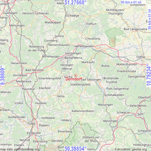
Dorndorf GPS coordinates[2]
50° 50' 4.992" North, 10° 5' 21.156" East
| Map corner | latitude | longitude |
|---|---|---|
| Upper-left | 51.27668°, | 9.38609° |
| Center: | 50.83472°, | 10.08921° |
| Lower-right: | 50.38854°, | 10.79234° |
| Map W x H: | 98.8×98.7 km | = 61.4×61.3mi |
| max Lat: | 55.01917° ⇑45.1% North |
| Dorndorf: | 50.83472° |
| min Lat: | ⇓54.9% South 47.40724° |
| min Long | Dorndorf | max Long |
| 5.92978° | 10.08921° | 14.98853° |
| W 51.5%⇐ | ⇒48.5% E |
Elevation
Elevation of Dorndorf is 250 m = 820 ft, and this is 0.90000000000001 m = 3 ft above average elevation for this country.
| Max E: |
1256 m = 4121 ft | 46.4% |
| Dorndorf | 250 m 820 ft | |
| Avg. | 249.1 m = 817 ft | |
Min E: |
-5 m = -16 ft | 53.6% |
See also: Germany elevation on elevation.city.
Geographical zone
Dorndorf is located in North temperate zone (between Tropic of Cancer and the Arctic Circle). Distance of this North polar circle is 1748.9 km =1086.7 mi to North.| Distance of | km | miles | from Dorndorf |
|---|---|---|---|
| North Pole | 4354.8 | 2705.9 | to North |
| Arctic Circle | 1748.9 | 1086.7 | to North |
| Tropic Cancer | 3046.4 | 1892.9 | to South |
| Equator | 5652.3 | 3512.2 | to South |


Nearby cities:
15 places around Dorndorf: (largest is in red/bold)
• Bad Salzungen
10.6 km =6.6 mi,  102°
102°
• Dippach
10 km =6.2 mi,  340°
340°
• Frauensee
6.1 km =3.8 mi,  37°
37°
• Heringen
8.3 km =5.2 mi,  315°
315°
• Leimbach
8 km =5 mi, 104°
• Martinroda
4.2 km =2.6 mi,  202°
202°
• Oechsen
10.1 km =6.3 mi,  190°
190°
• Philippsthal
5.7 km =3.5 mi,  275°
275°
• Stadtlengsfeld
6.4 km =4 mi,  153°
153°
• Tiefenort
5.4 km =3.4 mi,  84°
84°
• Unterbreizbach
7.7 km =4.8 mi,  254°
254°
• Vacha
4.8 km =3 mi,  260°
260°
• Völkershausen
4.7 km =2.9 mi,  215°
215°
• Weilar
8.7 km =5.4 mi, 150°
• Wölferbütt
8.1 km =5 mi, 200°
Sources, notices
• [Note1] Compared only with cities in Germany existing in our database
• [Src1] Map data: © OpenStreetMap contributors (CC-BY-SA)
• [Src2] Other city data from geonames.org with taken over terms of usage.
• [Src3] Geographical zone / Annual Mean Temperature by Robert A. Rohde @ Wikipedia
