Frauensee geodata
Frauensee (Thuringia) is a seat of a fourth-order administrative division; located in Germany in Europe/Berlin (GMT+2) time zone. With population of 952 people, there are 7340 cities with bigger population in this country. Compared to other cities in Germany, 55.7% of cities are located further ↓South; 52.3% of cities are located further ←West and 57.9% of cities have lower elevation than Frauensee. Note1


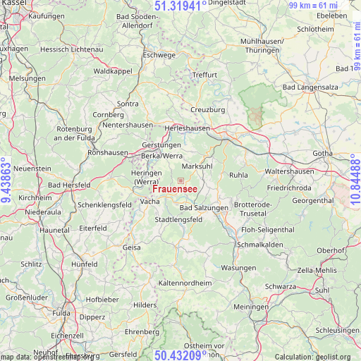
Frauensee GPS coordinates[2]
50° 52' 40.296" North, 10° 8' 30.3" East
| Map corner | latitude | longitude |
|---|---|---|
| Upper-left | 51.31941°, | 9.43863° |
| Center: | 50.87786°, | 10.14175° |
| Lower-right: | 50.43209°, | 10.84488° |
| Map W x H: | 98.7×98.7 km | = 61.3×61.3mi |
| max Lat: | 55.01917° ⇑44.3% North |
| Frauensee: | 50.87786° |
| min Lat: | ⇓55.7% South 47.40724° |
| min Long | Frauensee | max Long |
| 5.92978° | 10.14175° | 14.98853° |
| W 52.3%⇐ | ⇒47.7% E |
Elevation
Elevation of Frauensee is 278 m = 912 ft, and this is 28.9 m = 95 ft above average elevation for this country.
| Max E: |
1256 m = 4121 ft | 42.1% |
| Frauensee | 278 m 912 ft | |
| Avg. | 249.1 m = 817 ft | |
Min E: |
-5 m = -16 ft | 57.9% |
See also: Germany elevation on elevation.city.
Geographical zone
Frauensee is located in North temperate zone (between Tropic of Cancer and the Arctic Circle). Distance of this North polar circle is 1744.1 km =1083.7 mi to North.| Distance of | km | miles | from Frauensee |
|---|---|---|---|
| North Pole | 4350 | 2703 | to North |
| Arctic Circle | 1744.1 | 1083.7 | to North |
| Tropic Cancer | 3051.2 | 1895.9 | to South |
| Equator | 5657.1 | 3515.2 | to South |


Nearby cities:
15 places around Frauensee: (largest is in red/bold)
• Bad Salzungen
9.8 km =6.1 mi,  137°
137°
• Dankmarshausen
10.3 km =6.4 mi,  300°
300°
• Dippach
8.4 km =5.2 mi, 303°
• Dorndorf
6.1 km =3.8 mi,  217°
217°
• Ettenhausen
6.3 km =3.9 mi,  87°
87°
• Heringen
9.5 km =5.9 mi,  276°
276°
• Leimbach
7.9 km =4.9 mi,  148°
148°
• Marksuhl
5.9 km =3.7 mi,  43°
43°
• Martinroda
10.1 km =6.3 mi,  211°
211°
• Oberellen
8.4 km =5.2 mi,  21°
21°
• Philippsthal
10.2 km =6.3 mi,  245°
245°
• Stadtlengsfeld
10.6 km =6.6 mi,  184°
184°
• Tiefenort
4.6 km =2.9 mi,  158°
158°
• Unterellen
9.9 km =6.2 mi,  7°
7°
• Vacha
10.1 km =6.3 mi,  236°
236°
Sources, notices
• [Note1] Compared only with cities in Germany existing in our database
• [Src1] Map data: © OpenStreetMap contributors (CC-BY-SA)
• [Src2] Other city data from geonames.org with taken over terms of usage.
• [Src3] Geographical zone / Annual Mean Temperature by Robert A. Rohde @ Wikipedia
