Pausa geodata
Pausa (Saxony) is a populated place; located in Germany in Europe/Berlin (GMT+2) time zone. With population of 3,924 people, there are 3335 cities with bigger population in this country. Compared to other cities in Germany, 51.1% of cities are located further ↑North; 81.7% of cities are located further ←West and 81.7% of cities have lower elevation than Pausa. Note1


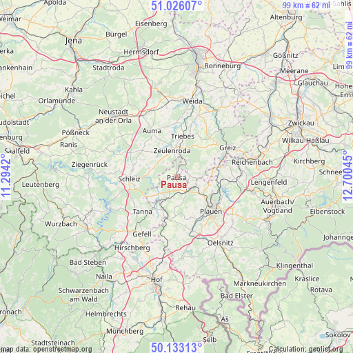
Pausa GPS coordinates[2]
50° 34' 54.192" North, 11° 59' 50.352" East
| Map corner | latitude | longitude |
|---|---|---|
| Upper-left | 51.02607°, | 11.2942° |
| Center: | 50.58172°, | 11.99732° |
| Lower-right: | 50.13313°, | 12.70045° |
| Map W x H: | 99.3×99.3 km | = 61.7×61.7mi |
| max Lat: | 55.01917° ⇑51.1% North |
| Pausa: | 50.58172° |
| min Lat: | ⇓48.9% South 47.40724° |
| min Long | Pausa | max Long |
| 5.92978° | 11.99732° | 14.98853° |
| W 81.7%⇐ | ⇒18.3% E |
Elevation
Elevation of Pausa is 444 m = 1457 ft, and this is 194.9 m = 639 ft above average elevation for this country.
| Max E: |
1256 m = 4121 ft | 18.3% |
| Pausa | 444 m 1457 ft | |
| Avg. | 249.1 m = 817 ft | |
Min E: |
-5 m = -16 ft | 81.7% |
See also: Germany elevation on elevation.city.
Geographical zone
Pausa is located in North temperate zone (between Tropic of Cancer and the Arctic Circle). Distance of this North polar circle is 1777 km =1104.2 mi to North.| Distance of | km | miles | from Pausa |
|---|---|---|---|
| North Pole | 4382.9 | 2723.4 | to North |
| Arctic Circle | 1777 | 1104.2 | to North |
| Tropic Cancer | 3018.2 | 1875.4 | to South |
| Equator | 5624.2 | 3494.7 | to South |


Nearby cities:
15 places around Pausa: (largest is in red/bold)
• Elsterberg
12.4 km =7.7 mi,  76°
76°
• Göschitz
10.9 km =6.8 mi,  301°
301°
• Kirschkau
8.2 km =5.1 mi,  288°
288°
• Langenwetzendorf
12.8 km =8 mi,  32°
32°
• Langenwolschendorf
6.7 km =4.2 mi,  332°
332°
• Löhma
10.8 km =6.7 mi, 287°
• Mehltheuer
4.9 km =3 mi,  145°
145°
• Mühltroff
6.8 km =4.2 mi,  225°
225°
• Oettersdorf
12.9 km =8 mi,  279°
279°
• Reuth
12.7 km =7.9 mi,  192°
192°
• Syrau
7.2 km =4.5 mi,  126°
126°
• Tegau
11.9 km =7.4 mi,  309°
309°
• Triebes
11.6 km =7.2 mi,  8°
8°
• Weißendorf
11.3 km =7 mi,  0°
0°
• Zeulenroda
8 km =5 mi,  353°
353°
Sources, notices
• [Note1] Compared only with cities in Germany existing in our database
• [Src1] Map data: © OpenStreetMap contributors (CC-BY-SA)
• [Src2] Other city data from geonames.org with taken over terms of usage.
• [Src3] Geographical zone / Annual Mean Temperature by Robert A. Rohde @ Wikipedia
