Oberreichenbach geodata
Oberreichenbach (Baden-Württemberg) is a seat of a fourth-order administrative division; located in Germany in Europe/Berlin (GMT+2) time zone. With population of 2,922 people, there are 4069 cities with bigger population in this country. Compared to other cities in Germany, 86.1% of cities are located further ↑North; 69.5% of cities are located further →East and 95.7% of cities have lower elevation than Oberreichenbach. Note1
Administrative division(s):
- Level 1: Baden-Württemberg
- Level 2: Karlsruhe Region
- Level 3: Landkreis Calw
- Level 4: Oberreichenbach


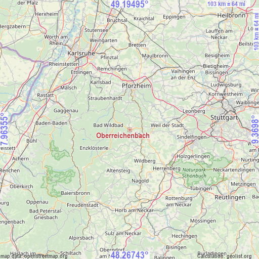
Oberreichenbach GPS coordinates[2]
48° 43' 59.988" North, 8° 40' 0.012" East
| Map corner | latitude | longitude |
|---|---|---|
| Upper-left | 49.19495°, | 7.96355° |
| Center: | 48.73333°, | 8.66667° |
| Lower-right: | 48.26743°, | 9.3698° |
| Map W x H: | 103.1×103.1 km | = 64.1×64.1mi |
| max Lat: | 55.01917° ⇑86.1% North |
| Oberreichenbach: | 48.73333° |
| min Lat: | ⇓13.9% South 47.40724° |
| min Long | Oberreichenbach | max Long |
| 5.92978° | 8.66667° | 14.98853° |
| W 30.5%⇐ | ⇒69.5% E |
Elevation
Elevation of Oberreichenbach is 617 m = 2024 ft, and this is 367.9 m = 1207 ft above average elevation for this country.
| Max E: |
1256 m = 4121 ft | 4.3% |
| Oberreichenbach | 617 m 2024 ft | |
| Avg. | 249.1 m = 817 ft | |
Min E: |
-5 m = -16 ft | 95.7% |
See also: Germany elevation on elevation.city.
Geographical zone
Oberreichenbach is located in North temperate zone (between Tropic of Cancer and the Arctic Circle). Distance of this North polar circle is 1982.5 km =1231.9 mi to North.| Distance of | km | miles | from Oberreichenbach |
|---|---|---|---|
| North Pole | 4588.4 | 2851.1 | to North |
| Arctic Circle | 1982.5 | 1231.9 | to North |
| Tropic Cancer | 2812.7 | 1747.7 | to South |
| Equator | 5418.6 | 3367 | to South |


Nearby cities:
15 places around Oberreichenbach: (largest is in red/bold)
• Althengstett
9.4 km =5.8 mi,  96°
96°
• Bad Liebenzell
6.5 km =4 mi,  45°
45°
• Bad Teinach-Zavelstein
5.1 km =3.2 mi,  158°
158°
• Bad Wildbad
8.7 km =5.4 mi,  282°
282°
• Calw
5.8 km =3.6 mi,  111°
111°
• Engelsbrand
11.2 km =7 mi,  353°
353°
• Gechingen
12.6 km =7.8 mi, 109°
• Holzbronn
10 km =6.2 mi,  145°
145°
• Höfen an der Enz
9.6 km =6 mi,  320°
320°
• Neubulach
8.3 km =5.2 mi, 164°
• Neuhausen
10.4 km =6.5 mi, 50°
• Neuweiler
8.9 km =5.5 mi,  213°
213°
• Schömberg
6.2 km =3.9 mi, 345°
• Simmozheim
10.8 km =6.7 mi,  79°
79°
• Unterreichenbach
10.6 km =6.6 mi,  16°
16°
Sources, notices
• [Note1] Compared only with cities in Germany existing in our database
• [Src1] Map data: © OpenStreetMap contributors (CC-BY-SA)
• [Src2] Other city data from geonames.org with taken over terms of usage.
• [Src3] Geographical zone / Annual Mean Temperature by Robert A. Rohde @ Wikipedia
