Oberkochen geodata
Oberkochen (Baden-Württemberg) is a populated place; located in Germany in Europe/Berlin (GMT+2) time zone. With population of 8,373 people, there are 1894 cities with bigger population in this country. Compared to other cities in Germany, 85.5% of cities are located further ↑North; 51.8% of cities are located further ←West and 88.1% of cities have lower elevation than Oberkochen. Note1
Administrative division(s):
- Level 1: Baden-Württemberg
- Level 2: Regierungsbezirk Stuttgart
- Level 3: Ostalbkreis
- Level 4: Oberkochen


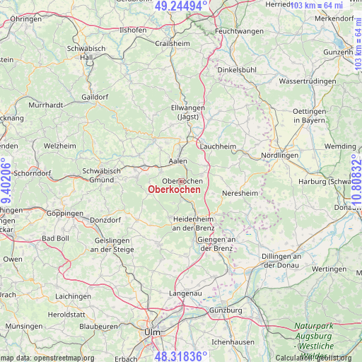
Oberkochen GPS coordinates[2]
48° 47' 1.644" North, 10° 6' 18.684" East
| Map corner | latitude | longitude |
|---|---|---|
| Upper-left | 49.24494°, | 9.40206° |
| Center: | 48.78379°, | 10.10519° |
| Lower-right: | 48.31836°, | 10.80832° |
| Map W x H: | 103×103 km | = 64×64mi |
| max Lat: | 55.01917° ⇑85.5% North |
| Oberkochen: | 48.78379° |
| min Lat: | ⇓14.5% South 47.40724° |
| min Long | Oberkochen | max Long |
| 5.92978° | 10.10519° | 14.98853° |
| W 51.8%⇐ | ⇒48.2% E |
Elevation
Elevation of Oberkochen is 495 m = 1624 ft, and this is 245.9 m = 807 ft above average elevation for this country.
| Max E: |
1256 m = 4121 ft | 11.9% |
| Oberkochen | 495 m 1624 ft | |
| Avg. | 249.1 m = 817 ft | |
Min E: |
-5 m = -16 ft | 88.1% |
See also: Germany elevation on elevation.city.
Geographical zone
Oberkochen is located in North temperate zone (between Tropic of Cancer and the Arctic Circle). Distance of this North polar circle is 1976.9 km =1228.4 mi to North.| Distance of | km | miles | from Oberkochen |
|---|---|---|---|
| North Pole | 4582.8 | 2847.6 | to North |
| Arctic Circle | 1976.9 | 1228.4 | to North |
| Tropic Cancer | 2818.3 | 1751.2 | to South |
| Equator | 5424.2 | 3370.4 | to South |


Nearby cities:
15 places around Oberkochen: (largest is in red/bold)
• Aalen
6.1 km =3.8 mi,  351°
351°
• Abtsgmünd
14.5 km =9 mi,  328°
328°
• Bartholomä
9.3 km =5.8 mi,  248°
248°
• Böbingen an der Rems
14 km =8.7 mi,  286°
286°
• Essingen
6.3 km =3.9 mi,  295°
295°
• Heidenheim an der Brenz
12.2 km =7.6 mi,  163°
163°
• Heubach
12.6 km =7.8 mi,  274°
274°
• Heuchlingen
14 km =8.7 mi, 302°
• Hüttlingen
12.1 km =7.5 mi,  358°
358°
• Königsbronn
4.5 km =2.8 mi,  173°
173°
• Lauchheim
14 km =8.7 mi,  45°
45°
• Mögglingen
11.3 km =7 mi, 292°
• Nattheim
13.7 km =8.5 mi,  132°
132°
• Steinheim am Albuch
10.8 km =6.7 mi,  196°
196°
• Westhausen
12.5 km =7.8 mi,  27°
27°
Sources, notices
• [Note1] Compared only with cities in Germany existing in our database
• [Src1] Map data: © OpenStreetMap contributors (CC-BY-SA)
• [Src2] Other city data from geonames.org with taken over terms of usage.
• [Src3] Geographical zone / Annual Mean Temperature by Robert A. Rohde @ Wikipedia
