Essingen geodata
Essingen (Baden-Württemberg) is a seat of a fourth-order administrative division; located in Germany in Europe/Berlin (GMT+2) time zone. With population of 6,383 people, there are 2339 cities with bigger population in this country. Compared to other cities in Germany, 85.2% of cities are located further ↑North; 50.6% of cities are located further ←West and 88.9% of cities have lower elevation than Essingen. Note1
Administrative division(s):
- Level 1: Baden-Württemberg
- Level 2: Regierungsbezirk Stuttgart
- Level 3: Ostalbkreis
- Level 4: Essingen


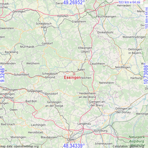
Essingen GPS coordinates[2]
48° 48' 30.924" North, 10° 1' 39.828" East
| Map corner | latitude | longitude |
|---|---|---|
| Upper-left | 49.26952°, | 9.3246° |
| Center: | 48.80859°, | 10.02773° |
| Lower-right: | 48.34339°, | 10.73086° |
| Map W x H: | 103×103 km | = 64×64mi |
| max Lat: | 55.01917° ⇑85.2% North |
| Essingen: | 48.80859° |
| min Lat: | ⇓14.8% South 47.40724° |
| min Long | Essingen | max Long |
| 5.92978° | 10.02773° | 14.98853° |
| W 50.6%⇐ | ⇒49.4% E |
Elevation
Elevation of Essingen is 503 m = 1650 ft, and this is 253.9 m = 833 ft above average elevation for this country.
| Max E: |
1256 m = 4121 ft | 11.1% |
| Essingen | 503 m 1650 ft | |
| Avg. | 249.1 m = 817 ft | |
Min E: |
-5 m = -16 ft | 88.9% |
See also: Germany elevation on elevation.city.
Geographical zone
Essingen is located in North temperate zone (between Tropic of Cancer and the Arctic Circle). Distance of this North polar circle is 1974.2 km =1226.7 mi to North.| Distance of | km | miles | from Essingen |
|---|---|---|---|
| North Pole | 4580.1 | 2845.9 | to North |
| Arctic Circle | 1974.2 | 1226.7 | to North |
| Tropic Cancer | 2821.1 | 1752.9 | to South |
| Equator | 5427 | 3372.2 | to South |


Nearby cities:
15 places around Essingen: (largest is in red/bold)
• Aalen
5.8 km =3.6 mi,  55°
55°
• Abtsgmünd
9.8 km =6.1 mi,  348°
348°
• Bartholomä
6.8 km =4.2 mi,  205°
205°
• Böbingen an der Rems
7.9 km =4.9 mi,  278°
278°
• Göggingen
12 km =7.5 mi,  299°
299°
• Heubach
7.1 km =4.4 mi,  255°
255°
• Heuchlingen
7.8 km =4.8 mi,  308°
308°
• Hüttlingen
10.8 km =6.7 mi,  29°
29°
• Iggingen
11.2 km =7 mi, 283°
• Königsbronn
9.5 km =5.9 mi,  139°
139°
• Leinzell
11.9 km =7.4 mi,  292°
292°
• Mögglingen
5 km =3.1 mi, 288°
• Obergröningen
12.9 km =8 mi,  317°
317°
• Oberkochen
6.3 km =3.9 mi,  115°
115°
• Schechingen
10.8 km =6.7 mi, 311°
Sources, notices
• [Note1] Compared only with cities in Germany existing in our database
• [Src1] Map data: © OpenStreetMap contributors (CC-BY-SA)
• [Src2] Other city data from geonames.org with taken over terms of usage.
• [Src3] Geographical zone / Annual Mean Temperature by Robert A. Rohde @ Wikipedia
