Nieheim geodata
Nieheim (North Rhine-Westphalia) is a populated place; located in Germany in Europe/Berlin (GMT+2) time zone. With population of 6,961 people, there are 2194 cities with bigger population in this country. Compared to other cities in Germany, 70% of cities are located further ↓South; 63.8% of cities are located further →East and 53.4% of cities have higher elevation than Nieheim. Note1
Administrative division(s):
- Level 1: North Rhine-Westphalia
- Level 2: Regierungsbezirk Detmold
- Level 3: Kreis Höxter
- Level 4: Nieheim


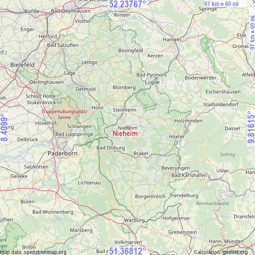
Nieheim GPS coordinates[2]
51° 48' 17.964" North, 9° 6' 46.872" East
| Map corner | latitude | longitude |
|---|---|---|
| Upper-left | 52.23767°, | 8.4099° |
| Center: | 51.80499°, | 9.11302° |
| Lower-right: | 51.36812°, | 9.81615° |
| Map W x H: | 96.7×96.7 km | = 60.1×60.1mi |
| max Lat: | 55.01917° ⇑30% North |
| Nieheim: | 51.80499° |
| min Lat: | ⇓70% South 47.40724° |
| min Long | Nieheim | max Long |
| 5.92978° | 9.11302° | 14.98853° |
| W 36.2%⇐ | ⇒63.8% E |
Elevation
Elevation of Nieheim is 201 m = 659 ft, and this is 48.1 m = 158 ft below average elevation for this country.
| Max E: |
1256 m = 4121 ft | 53.4% |
| Avg. | 249.1 m = 817 ft | |
| Nieheim | 201 m = 659 ft | |
Min E: |
-5 m = -16 ft | 46.6% |
See also: Germany elevation on elevation.city.
Geographical zone
Nieheim is located in North temperate zone (between Tropic of Cancer and the Arctic Circle). Distance of this North polar circle is 1641 km =1019.7 mi to North.| Distance of | km | miles | from Nieheim |
|---|---|---|---|
| North Pole | 4246.9 | 2638.9 | to North |
| Arctic Circle | 1641 | 1019.7 | to North |
| Tropic Cancer | 3154.3 | 1960 | to South |
| Equator | 5760.2 | 3579.2 | to South |


Nearby cities:
15 places around Nieheim: (largest is in red/bold)
• Altenbeken
12.6 km =7.8 mi,  249°
249°
• Bad Driburg
10.3 km =6.4 mi,  218°
218°
• Bad Lippspringe
20.5 km =12.7 mi,  263°
263°
• Bad Meinberg
13.5 km =8.4 mi,  318°
318°
• Blomberg
15.5 km =9.6 mi,  354°
354°
• Boffzen
19.6 km =12.2 mi,  108°
108°
• Brakel
10.9 km =6.8 mi,  152°
152°
• Horn
13.7 km =8.5 mi,  302°
302°
• Horn-Bad Meinberg
13.7 km =8.5 mi,  310°
310°
• Höxter
18.8 km =11.7 mi,  100°
100°
• Lügde
19.4 km =12.1 mi,  28°
28°
• Schieder-Schwalenberg
9.8 km =6.1 mi,  35°
35°
• Schlangen
18.4 km =11.4 mi,  271°
271°
• Steinheim
7.5 km =4.7 mi, 348°
• Vahlbruch
20.2 km =12.6 mi,  50°
50°
Sources, notices
• [Note1] Compared only with cities in Germany existing in our database
• [Src1] Map data: © OpenStreetMap contributors (CC-BY-SA)
• [Src2] Other city data from geonames.org with taken over terms of usage.
• [Src3] Geographical zone / Annual Mean Temperature by Robert A. Rohde @ Wikipedia
