Nideggen geodata
Nideggen (North Rhine-Westphalia) is a populated place; located in Germany in Europe/Berlin (GMT+2) time zone. With population of 10,727 people, there are 1544 cities with bigger population in this country. Compared to other cities in Germany, 51.8% of cities are located further ↓South; 97.8% of cities are located further →East and 61.9% of cities have lower elevation than Nideggen. Note1
Administrative division(s):
- Level 1: North Rhine-Westphalia
- Level 2: Regierungsbezirk Köln
- Level 3: Kreis Düren
- Level 4: Nideggen


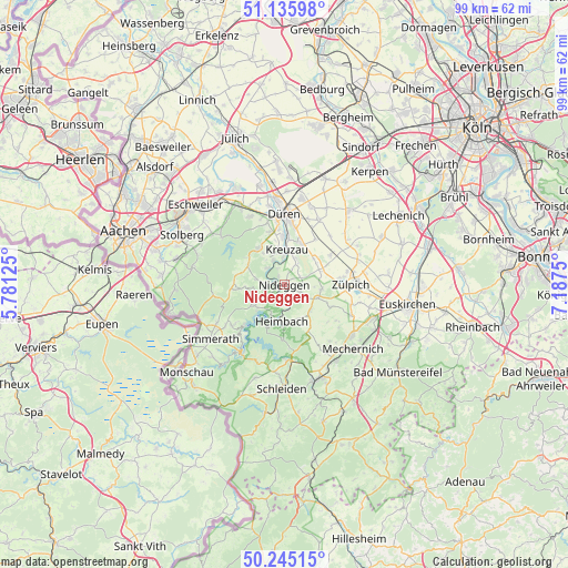
Nideggen GPS coordinates[2]
50° 41' 33.648" North, 6° 29' 3.732" East
| Map corner | latitude | longitude |
|---|---|---|
| Upper-left | 51.13598°, | 5.78125° |
| Center: | 50.69268°, | 6.48437° |
| Lower-right: | 50.24515°, | 7.1875° |
| Map W x H: | 99.1×99 km | = 61.6×61.5mi |
| max Lat: | 55.01917° ⇑48.2% North |
| Nideggen: | 50.69268° |
| min Lat: | ⇓51.8% South 47.40724° |
| min Long | Nideggen | max Long |
| 5.92978° | 6.48437° | 14.98853° |
| W 2.2%⇐ | ⇒97.8% E |
Elevation
Elevation of Nideggen is 301 m = 988 ft, and this is 51.9 m = 170 ft above average elevation for this country.
| Max E: |
1256 m = 4121 ft | 38.1% |
| Nideggen | 301 m 988 ft | |
| Avg. | 249.1 m = 817 ft | |
Min E: |
-5 m = -16 ft | 61.9% |
See also: Germany elevation on elevation.city.
Geographical zone
Nideggen is located in North temperate zone (between Tropic of Cancer and the Arctic Circle). Distance of this North polar circle is 1764.7 km =1096.5 mi to North.| Distance of | km | miles | from Nideggen |
|---|---|---|---|
| North Pole | 4370.6 | 2715.8 | to North |
| Arctic Circle | 1764.7 | 1096.5 | to North |
| Tropic Cancer | 3030.6 | 1883.1 | to South |
| Equator | 5636.5 | 3502.4 | to South |


Nearby cities:
15 places around Nideggen: (largest is in red/bold)
• Breinigerberg
18 km =11.2 mi,  285°
285°
• Düren
12.4 km =7.7 mi,  2°
2°
• Einruhr
14.1 km =8.8 mi,  210°
210°
• Heimbach
6.3 km =3.9 mi,  189°
189°
• Hürtgenwald
8.7 km =5.4 mi, 287°
• Kall
17.6 km =10.9 mi,  161°
161°
• Kreuzau
6.1 km =3.8 mi, 4°
• Langerwehe
16.7 km =10.4 mi,  325°
325°
• Mechernich
16.2 km =10.1 mi,  133°
133°
• Merzenich
15.2 km =9.4 mi,  10°
10°
• Nörvenich
16.7 km =10.4 mi,  40°
40°
• Rurberg
11.4 km =7.1 mi,  219°
219°
• Simmerath
16.6 km =10.3 mi,  231°
231°
• Vettweiß
9.3 km =5.8 mi,  60°
60°
• Zulpich
12 km =7.5 mi,  89°
89°
Sources, notices
• [Note1] Compared only with cities in Germany existing in our database
• [Src1] Map data: © OpenStreetMap contributors (CC-BY-SA)
• [Src2] Other city data from geonames.org with taken over terms of usage.
• [Src3] Geographical zone / Annual Mean Temperature by Robert A. Rohde @ Wikipedia
