Zulpich geodata
Zulpich (North Rhine-Westphalia) is a populated place; located in Germany in Europe/Berlin (GMT+2) time zone. With population of 20,208 people, there are 766 cities with bigger population in this country. Compared to other cities in Germany, 51.9% of cities are located further ↓South; 96.7% of cities are located further →East and 57% of cities have higher elevation than Zulpich. Note1
Administrative division(s):
- Level 1: North Rhine-Westphalia
- Level 2: Regierungsbezirk Köln
- Level 3: Kreis Euskirchen
- Level 4: Zülpich


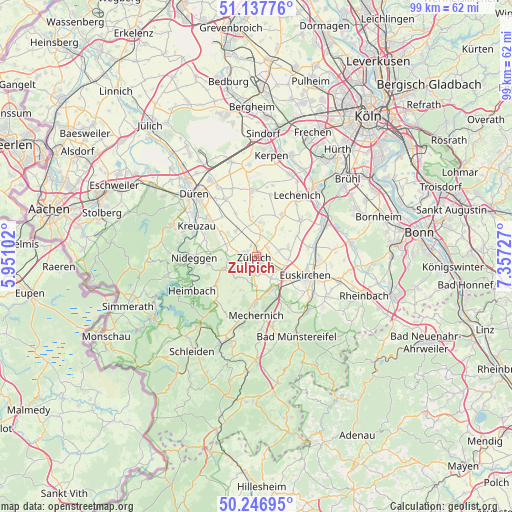
Zulpich GPS coordinates[2]
50° 41' 40.092" North, 6° 39' 14.904" East
| Map corner | latitude | longitude |
|---|---|---|
| Upper-left | 51.13776°, | 5.95102° |
| Center: | 50.69447°, | 6.65414° |
| Lower-right: | 50.24695°, | 7.35727° |
| Map W x H: | 99×99 km | = 61.5×61.5mi |
| max Lat: | 55.01917° ⇑48.1% North |
| Zulpich: | 50.69447° |
| min Lat: | ⇓51.9% South 47.40724° |
| min Long | Zulpich | max Long |
| 5.92978° | 6.65414° | 14.98853° |
| W 3.3%⇐ | ⇒96.7% E |
Elevation
Elevation of Zulpich is 174 m = 571 ft, and this is 75.1 m = 246 ft below average elevation for this country.
| Max E: |
1256 m = 4121 ft | 57% |
| Avg. | 249.1 m = 817 ft | |
| Zulpich | 174 m = 571 ft | |
Min E: |
-5 m = -16 ft | 43% |
See also: Germany elevation on elevation.city.
Geographical zone
Zulpich is located in North temperate zone (between Tropic of Cancer and the Arctic Circle). Distance of this North polar circle is 1764.5 km =1096.4 mi to North.| Distance of | km | miles | from Zulpich |
|---|---|---|---|
| North Pole | 4370.4 | 2715.6 | to North |
| Arctic Circle | 1764.5 | 1096.4 | to North |
| Tropic Cancer | 3030.8 | 1883.3 | to South |
| Equator | 5636.7 | 3502.5 | to South |


Nearby cities:
15 places around Zulpich: (largest is in red/bold)
• Bad Münstereifel
17.2 km =10.7 mi,  153°
153°
• Düren
16.7 km =10.4 mi,  317°
317°
• Erftstadt
16.6 km =10.3 mi,  36°
36°
• Euskirchen
10.1 km =6.3 mi,  111°
111°
• Heimbach
14.5 km =9 mi,  243°
243°
• Kall
18.1 km =11.2 mi,  200°
200°
• Kerpen
19.7 km =12.2 mi,  8°
8°
• Kreuzau
12.9 km =8 mi,  296°
296°
• Mechernich
11.3 km =7 mi,  180°
180°
• Merzenich
17.3 km =10.7 mi,  328°
328°
• Nideggen
12 km =7.5 mi,  269°
269°
• Nörvenich
12.4 km =7.7 mi,  355°
355°
• Türnich
19.6 km =12.2 mi,  21°
21°
• Vettweiß
5.8 km =3.6 mi, 318°
• Weilerswist
15 km =9.3 mi,  64°
64°
Sources, notices
• [Note1] Compared only with cities in Germany existing in our database
• [Src1] Map data: © OpenStreetMap contributors (CC-BY-SA)
• [Src2] Other city data from geonames.org with taken over terms of usage.
• [Src3] Geographical zone / Annual Mean Temperature by Robert A. Rohde @ Wikipedia
