Mechernich geodata
Mechernich (North Rhine-Westphalia) is a populated place; located in Germany in Europe/Berlin (GMT+2) time zone. With population of 27,537 people, there are 519 cities with bigger population in this country. Compared to other cities in Germany, 50.7% of cities are located further ↑North; 96.7% of cities are located further →East and 61.9% of cities have lower elevation than Mechernich. Note1
Administrative division(s):
- Level 1: North Rhine-Westphalia
- Level 2: Regierungsbezirk Köln
- Level 3: Kreis Euskirchen
- Level 4: Mechernich


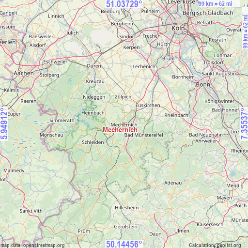
Mechernich GPS coordinates[2]
50° 35' 34.944" North, 6° 39' 8.064" East
| Map corner | latitude | longitude |
|---|---|---|
| Upper-left | 51.03729°, | 5.94912° |
| Center: | 50.59304°, | 6.65224° |
| Lower-right: | 50.14456°, | 7.35537° |
| Map W x H: | 99.3×99.3 km | = 61.7×61.7mi |
| max Lat: | 55.01917° ⇑50.7% North |
| Mechernich: | 50.59304° |
| min Lat: | ⇓49.3% South 47.40724° |
| min Long | Mechernich | max Long |
| 5.92978° | 6.65224° | 14.98853° |
| W 3.3%⇐ | ⇒96.7% E |
Elevation
Elevation of Mechernich is 301 m = 988 ft, and this is 51.9 m = 170 ft above average elevation for this country.
| Max E: |
1256 m = 4121 ft | 38.1% |
| Mechernich | 301 m 988 ft | |
| Avg. | 249.1 m = 817 ft | |
Min E: |
-5 m = -16 ft | 61.9% |
See also: Germany elevation on elevation.city.
Geographical zone
Mechernich is located in North temperate zone (between Tropic of Cancer and the Arctic Circle). Distance of this North polar circle is 1775.8 km =1103.4 mi to North.| Distance of | km | miles | from Mechernich |
|---|---|---|---|
| North Pole | 4381.6 | 2722.6 | to North |
| Arctic Circle | 1775.8 | 1103.4 | to North |
| Tropic Cancer | 3019.5 | 1876.2 | to South |
| Equator | 5625.4 | 3495.5 | to South |


Nearby cities:
15 places around Mechernich: (largest is in red/bold)
• Bad Münstereifel
8.9 km =5.5 mi,  117°
117°
• Blankenheim
17.8 km =11.1 mi,  180°
180°
• Einruhr
19.2 km =11.9 mi,  266°
266°
• Euskirchen
12.1 km =7.5 mi,  51°
51°
• Heimbach
13.8 km =8.6 mi,  290°
290°
• Hümmel
16.8 km =10.4 mi,  146°
146°
• Kall
8.5 km =5.3 mi,  228°
228°
• Kirchsahr
19.2 km =11.9 mi,  114°
114°
• Nettersheim
11.2 km =7 mi,  188°
188°
• Nideggen
16.2 km =10.1 mi,  313°
313°
• Ohlenhard
17.8 km =11.1 mi, 153°
• Rurberg
19.2 km =11.9 mi,  276°
276°
• Schleiden
14.3 km =8.9 mi,  240°
240°
• Vettweiß
16 km =9.9 mi,  346°
346°
• Zulpich
11.3 km =7 mi,  0°
0°
Sources, notices
• [Note1] Compared only with cities in Germany existing in our database
• [Src1] Map data: © OpenStreetMap contributors (CC-BY-SA)
• [Src2] Other city data from geonames.org with taken over terms of usage.
• [Src3] Geographical zone / Annual Mean Temperature by Robert A. Rohde @ Wikipedia
