Natendorf geodata
Natendorf (Lower Saxony) is a seat of a fourth-order administrative division; located in Germany in Europe/Berlin (GMT+2) time zone. With population of 869 people, there are 7633 cities with bigger population in this country. Compared to other cities in Germany, 82.2% of cities are located further ↓South; 58.4% of cities are located further ←West and 79.4% of cities have higher elevation than Natendorf. Note1


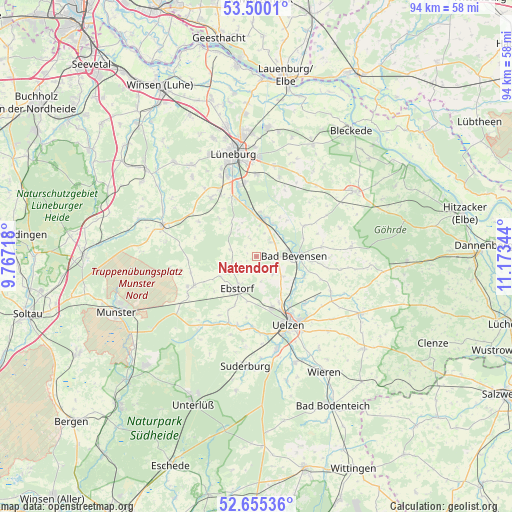
Natendorf GPS coordinates[2]
53° 4' 47.28" North, 10° 28' 13.116" East
| Map corner | latitude | longitude |
|---|---|---|
| Upper-left | 53.5001°, | 9.76718° |
| Center: | 53.0798°, | 10.47031° |
| Lower-right: | 52.65536°, | 11.17344° |
| Map W x H: | 93.9×93.9 km | = 58.3×58.3mi |
| max Lat: | 55.01917° ⇑17.8% North |
| Natendorf: | 53.0798° |
| min Lat: | ⇓82.2% South 47.40724° |
| min Long | Natendorf | max Long |
| 5.92978° | 10.47031° | 14.98853° |
| W 58.4%⇐ | ⇒41.6% E |
Elevation
Elevation of Natendorf is 48 m = 157 ft, and this is 201.1 m = 660 ft below average elevation for this country.
| Max E: |
1256 m = 4121 ft | 79.4% |
| Avg. | 249.1 m = 817 ft | |
| Natendorf | 48 m = 157 ft | |
Min E: |
-5 m = -16 ft | 20.6% |
See also: Germany elevation on elevation.city.
Geographical zone
Natendorf is located in North temperate zone (between Tropic of Cancer and the Arctic Circle). Distance of this North polar circle is 1499.3 km =931.6 mi to North.| Distance of | km | miles | from Natendorf |
|---|---|---|---|
| North Pole | 4105.1 | 2550.8 | to North |
| Arctic Circle | 1499.3 | 931.6 | to North |
| Tropic Cancer | 3296 | 2048 | to South |
| Equator | 5901.9 | 3667.3 | to South |


Nearby cities:
15 places around Natendorf: (largest is in red/bold)
• Altenmedingen
10.4 km =6.5 mi,  57°
57°
• Bad Bevensen
7.4 km =4.6 mi,  90°
90°
• Barnstedt
9.1 km =5.7 mi,  310°
310°
• Barum
4.5 km =2.8 mi,  136°
136°
• Betzendorf
12.3 km =7.6 mi,  301°
301°
• Bienenbüttel
7 km =4.3 mi,  9°
9°
• Ebstorf
6.7 km =4.2 mi,  210°
210°
• Emmendorf
9.1 km =5.7 mi, 136°
• Gerdau
13.1 km =8.1 mi,  195°
195°
• Hanstedt Eins
7.4 km =4.6 mi,  239°
239°
• Jelmstorf
4.2 km =2.6 mi, 55°
• Melbeck
12.4 km =7.7 mi,  337°
337°
• Römstedt
12.2 km =7.6 mi,  79°
79°
• Schwienau
8.4 km =5.2 mi,  191°
191°
• Wriedel
12.7 km =7.9 mi, 244°
Sources, notices
• [Note1] Compared only with cities in Germany existing in our database
• [Src1] Map data: © OpenStreetMap contributors (CC-BY-SA)
• [Src2] Other city data from geonames.org with taken over terms of usage.
• [Src3] Geographical zone / Annual Mean Temperature by Robert A. Rohde @ Wikipedia
