Meinerzhagen geodata
Meinerzhagen (North Rhine-Westphalia) is a populated place; located in Germany in Europe/Berlin (GMT+2) time zone. With population of 21,982 people, there are 683 cities with bigger population in this country. Compared to other cities in Germany, 60% of cities are located further ↓South; 84% of cities are located further →East and 75.2% of cities have lower elevation than Meinerzhagen. Note1
Administrative division(s):
- Level 1: North Rhine-Westphalia
- Level 2: Regierungsbezirk Arnsberg
- Level 3: Märkischer Kreis
- Level 4: Meinerzhagen


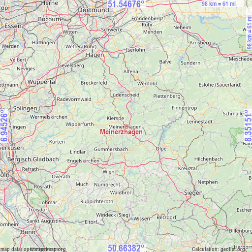
Meinerzhagen GPS coordinates[2]
51° 6' 26.64" North, 7° 38' 54.168" East
| Map corner | latitude | longitude |
|---|---|---|
| Upper-left | 51.54676°, | 6.94526° |
| Center: | 51.1074°, | 7.64838° |
| Lower-right: | 50.66382°, | 8.35151° |
| Map W x H: | 98.2×98.2 km | = 61×61mi |
| max Lat: | 55.01917° ⇑40% North |
| Meinerzhagen: | 51.1074° |
| min Lat: | ⇓60% South 47.40724° |
| min Long | Meinerzhagen | max Long |
| 5.92978° | 7.64838° | 14.98853° |
| W 16%⇐ | ⇒84% E |
Elevation
Elevation of Meinerzhagen is 399 m = 1309 ft, and this is 149.9 m = 492 ft above average elevation for this country.
| Max E: |
1256 m = 4121 ft | 24.8% |
| Meinerzhagen | 399 m 1309 ft | |
| Avg. | 249.1 m = 817 ft | |
Min E: |
-5 m = -16 ft | 75.2% |
See also: Germany elevation on elevation.city.
Geographical zone
Meinerzhagen is located in North temperate zone (between Tropic of Cancer and the Arctic Circle). Distance of this North polar circle is 1718.6 km =1067.9 mi to North.| Distance of | km | miles | from Meinerzhagen |
|---|---|---|---|
| North Pole | 4324.5 | 2687.1 | to North |
| Arctic Circle | 1718.6 | 1067.9 | to North |
| Tropic Cancer | 3076.7 | 1911.8 | to South |
| Equator | 5682.6 | 3531 | to South |


Nearby cities:
15 places around Meinerzhagen: (largest is in red/bold)
• Attendorn
17.9 km =11.1 mi,  83°
83°
• Bergneustadt
9.2 km =5.7 mi,  176°
176°
• Drolshagen
12.8 km =8 mi,  136°
136°
• Gummersbach
10.8 km =6.7 mi,  212°
212°
• Halver
13.7 km =8.5 mi,  309°
309°
• Herscheid
10.4 km =6.5 mi,  39°
39°
• Kierspe
5 km =3.1 mi, 306°
• Lüdenscheid
12.6 km =7.8 mi,  353°
353°
• Marienheide
8.6 km =5.3 mi,  251°
251°
• Olpe
16.6 km =10.3 mi,  121°
121°
• Plettenberg
19.3 km =12 mi,  54°
54°
• Schalksmühle
17.1 km =10.6 mi,  330°
330°
• Werdohl
18.9 km =11.7 mi,  25°
25°
• Wiehl
18.8 km =11.7 mi,  201°
201°
• Wipperfürth
17.5 km =10.9 mi,  273°
273°
Sources, notices
• [Note1] Compared only with cities in Germany existing in our database
• [Src1] Map data: © OpenStreetMap contributors (CC-BY-SA)
• [Src2] Other city data from geonames.org with taken over terms of usage.
• [Src3] Geographical zone / Annual Mean Temperature by Robert A. Rohde @ Wikipedia
