Olpe geodata
Olpe (North Rhine-Westphalia) is a seat of a third-order administrative division; located in Germany in Europe/Berlin (GMT+2) time zone. With population of 25,686 people, there are 564 cities with bigger population in this country. Compared to other cities in Germany, 58.6% of cities are located further ↓South; 80% of cities are located further →East and 65% of cities have lower elevation than Olpe. Note1
Administrative division(s):
- Level 1: North Rhine-Westphalia
- Level 2: Regierungsbezirk Arnsberg
- Level 3: Kreis Olpe
- Level 4: Olpe


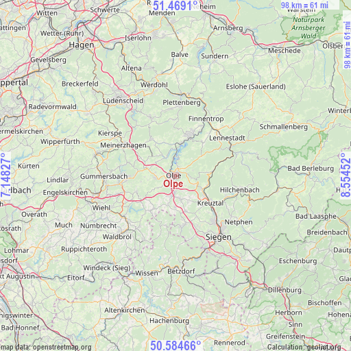
Olpe GPS coordinates[2]
51° 1' 44.364" North, 7° 51' 5.004" East
| Map corner | latitude | longitude |
|---|---|---|
| Upper-left | 51.4691°, | 7.14827° |
| Center: | 51.02899°, | 7.85139° |
| Lower-right: | 50.58466°, | 8.55452° |
| Map W x H: | 98.3×98.3 km | = 61.1×61.1mi |
| max Lat: | 55.01917° ⇑41.4% North |
| Olpe: | 51.02899° |
| min Lat: | ⇓58.6% South 47.40724° |
| min Long | Olpe | max Long |
| 5.92978° | 7.85139° | 14.98853° |
| W 20%⇐ | ⇒80% E |
Elevation
Elevation of Olpe is 321 m = 1053 ft, and this is 71.9 m = 236 ft above average elevation for this country.
| Max E: |
1256 m = 4121 ft | 35% |
| Olpe | 321 m 1053 ft | |
| Avg. | 249.1 m = 817 ft | |
Min E: |
-5 m = -16 ft | 65% |
See also: Germany elevation on elevation.city.
Geographical zone
Olpe is located in North temperate zone (between Tropic of Cancer and the Arctic Circle). Distance of this North polar circle is 1727.3 km =1073.3 mi to North.| Distance of | km | miles | from Olpe |
|---|---|---|---|
| North Pole | 4333.2 | 2692.5 | to North |
| Arctic Circle | 1727.3 | 1073.3 | to North |
| Tropic Cancer | 3068 | 1906.4 | to South |
| Equator | 5673.9 | 3525.6 | to South |


Nearby cities:
15 places around Olpe: (largest is in red/bold)
• Attendorn
11.4 km =7.1 mi,  18°
18°
• Bamenohl
17.8 km =11.1 mi,  31°
31°
• Bergneustadt
13.7 km =8.5 mi,  268°
268°
• Drolshagen
5.5 km =3.4 mi,  263°
263°
• Finnentrop
17.6 km =10.9 mi, 28°
• Freudenberg
14.7 km =9.1 mi,  173°
173°
• Friesenhagen
14.2 km =8.8 mi,  191°
191°
• Herscheid
18.3 km =11.4 mi,  335°
335°
• Hilchenbach
18.5 km =11.5 mi,  101°
101°
• Kirchhundem
17.8 km =11.1 mi,  69°
69°
• Kreuztal
11.8 km =7.3 mi,  125°
125°
• Lennestadt
18 km =11.2 mi,  56°
56°
• Meinerzhagen
16.6 km =10.3 mi,  301°
301°
• Niederfischbach
19.9 km =12.4 mi,  176°
176°
• Wenden
7 km =4.3 mi, 171°
Sources, notices
• [Note1] Compared only with cities in Germany existing in our database
• [Src1] Map data: © OpenStreetMap contributors (CC-BY-SA)
• [Src2] Other city data from geonames.org with taken over terms of usage.
• [Src3] Geographical zone / Annual Mean Temperature by Robert A. Rohde @ Wikipedia
