Kamp-Bornhofen geodata
Kamp-Bornhofen (Rheinland-Pfalz) is a seat of a fourth-order administrative division; located in Germany in Europe/Berlin (GMT+2) time zone. With population of 1,632 people, there are 5633 cities with bigger population in this country. Compared to other cities in Germany, 58.5% of cities are located further ↑North; 84.5% of cities are located further →East and 70.4% of cities have higher elevation than Kamp-Bornhofen. Note1
Administrative division(s):
- Level 1: Rheinland-Pfalz
- Level 3: Rhein-Lahn-Kreis
- Level 4: Kamp-Bornhofen


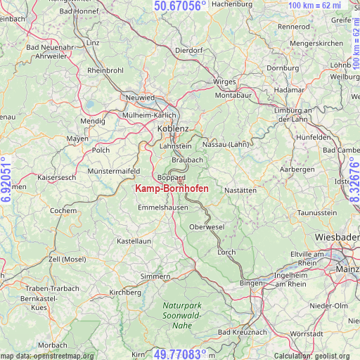
Kamp-Bornhofen GPS coordinates[2]
50° 13' 22.152" North, 7° 37' 25.104" East
| Map corner | latitude | longitude |
|---|---|---|
| Upper-left | 50.67056°, | 6.92051° |
| Center: | 50.22282°, | 7.62364° |
| Lower-right: | 49.77083°, | 8.32676° |
| Map W x H: | 100×100 km | = 62.1×62.1mi |
| max Lat: | 55.01917° ⇑58.5% North |
| Kamp-Bornhofen: | 50.22282° |
| min Lat: | ⇓41.5% South 47.40724° |
| min Long | Kamp-Bornhofen | max Long |
| 5.92978° | 7.62364° | 14.98853° |
| W 15.5%⇐ | ⇒84.5% E |
Elevation
Elevation of Kamp-Bornhofen is 89 m = 292 ft, and this is 160.1 m = 525 ft below average elevation for this country.
| Max E: |
1256 m = 4121 ft | 70.4% |
| Avg. | 249.1 m = 817 ft | |
| Kamp-Bornhofen | 89 m = 292 ft | |
Min E: |
-5 m = -16 ft | 29.6% |
See also: Germany elevation on elevation.city.
Geographical zone
Kamp-Bornhofen is located in North temperate zone (between Tropic of Cancer and the Arctic Circle). Distance of this North polar circle is 1816.9 km =1129 mi to North.| Distance of | km | miles | from Kamp-Bornhofen |
|---|---|---|---|
| North Pole | 4422.8 | 2748.2 | to North |
| Arctic Circle | 1816.9 | 1129 | to North |
| Tropic Cancer | 2978.3 | 1850.6 | to South |
| Equator | 5584.3 | 3469.9 | to South |


Nearby cities:
15 places around Kamp-Bornhofen: (largest is in red/bold)
• Boppard
2.6 km =1.6 mi,  290°
290°
• Braubach
5.8 km =3.6 mi,  15°
15°
• Brey
5.5 km =3.4 mi,  2°
2°
• Dahlheim
5.3 km =3.3 mi,  105°
105°
• Eschbach
7.4 km =4.6 mi,  97°
97°
• Filsen
3.4 km =2.1 mi,  304°
304°
• Halsenbach
7.4 km =4.6 mi,  219°
219°
• Kestert
4.8 km =3 mi,  156°
156°
• Kratzenburg
6.8 km =4.2 mi,  230°
230°
• Lykershausen
4 km =2.5 mi,  129°
129°
• Ney
7.8 km =4.8 mi,  235°
235°
• Osterspai
2.5 km =1.6 mi,  341°
341°
• Prath
5.2 km =3.2 mi,  124°
124°
• Rhens
6.5 km =4 mi,  356°
356°
• Spay
4.4 km =2.7 mi, 23°
Sources, notices
• [Note1] Compared only with cities in Germany existing in our database
• [Src1] Map data: © OpenStreetMap contributors (CC-BY-SA)
• [Src2] Other city data from geonames.org with taken over terms of usage.
• [Src3] Geographical zone / Annual Mean Temperature by Robert A. Rohde @ Wikipedia
