Fichtenberg geodata
Fichtenberg (Baden-Württemberg) is a seat of a fourth-order administrative division; located in Germany in Europe/Berlin (GMT+2) time zone. With population of 2,894 people, there are 4104 cities with bigger population in this country. Compared to other cities in Germany, 83.2% of cities are located further ↑North; 54.2% of cities are located further →East and 68.3% of cities have lower elevation than Fichtenberg. Note1
Administrative division(s):
- Level 1: Baden-Württemberg
- Level 2: Regierungsbezirk Stuttgart
- Level 3: Landkreis Schwäbisch Hall
- Level 4: Fichtenberg


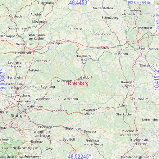
Fichtenberg GPS coordinates[2]
48° 59' 9.636" North, 9° 42' 43.164" East
| Map corner | latitude | longitude |
|---|---|---|
| Upper-left | 49.4453°, | 9.00887° |
| Center: | 48.98601°, | 9.71199° |
| Lower-right: | 48.52245°, | 10.41512° |
| Map W x H: | 102.6×102.6 km | = 63.8×63.8mi |
| max Lat: | 55.01917° ⇑83.2% North |
| Fichtenberg: | 48.98601° |
| min Lat: | ⇓16.8% South 47.40724° |
| min Long | Fichtenberg | max Long |
| 5.92978° | 9.71199° | 14.98853° |
| W 45.8%⇐ | ⇒54.2% E |
Elevation
Elevation of Fichtenberg is 345 m = 1132 ft, and this is 95.9 m = 315 ft above average elevation for this country.
| Max E: |
1256 m = 4121 ft | 31.7% |
| Fichtenberg | 345 m 1132 ft | |
| Avg. | 249.1 m = 817 ft | |
Min E: |
-5 m = -16 ft | 68.3% |
See also: Germany elevation on elevation.city.
Geographical zone
Fichtenberg is located in North temperate zone (between Tropic of Cancer and the Arctic Circle). Distance of this North polar circle is 1954.4 km =1214.4 mi to North.| Distance of | km | miles | from Fichtenberg |
|---|---|---|---|
| North Pole | 4560.3 | 2833.6 | to North |
| Arctic Circle | 1954.4 | 1214.4 | to North |
| Tropic Cancer | 2840.8 | 1765.2 | to South |
| Equator | 5446.7 | 3384.4 | to South |


Nearby cities:
15 places around Fichtenberg: (largest is in red/bold)
• Althütte
13 km =8.1 mi,  232°
232°
• Bühlerzell
15.3 km =9.5 mi,  82°
82°
• Gaildorf
4.5 km =2.8 mi,  69°
69°
• Gerabronn
15.3 km =9.5 mi,  96°
96°
• Gschwend
6.3 km =3.9 mi,  158°
158°
• Kaisersbach
8.2 km =5.1 mi,  220°
220°
• Mainhardt
15.1 km =9.4 mi,  311°
311°
• Michelbach an der Bilz
10.1 km =6.3 mi,  21°
21°
• Michelfeld
12.6 km =7.8 mi,  348°
348°
• Murrhardt
10.3 km =6.4 mi,  267°
267°
• Oberrot
4.5 km =2.8 mi, 314°
• Ruppertshofen
13.7 km =8.5 mi,  146°
146°
• Schwäbisch Hall
14.1 km =8.8 mi,  8°
8°
• Spraitbach
12.3 km =7.6 mi, 162°
• Welzheim
13.4 km =8.3 mi,  205°
205°
Sources, notices
• [Note1] Compared only with cities in Germany existing in our database
• [Src1] Map data: © OpenStreetMap contributors (CC-BY-SA)
• [Src2] Other city data from geonames.org with taken over terms of usage.
• [Src3] Geographical zone / Annual Mean Temperature by Robert A. Rohde @ Wikipedia
