Görsbach geodata
Görsbach (Thuringia) is a seat of a fourth-order administrative division; located in Germany in Europe/Berlin (GMT+2) time zone. With population of 1,175 people, there are 6636 cities with bigger population in this country. Compared to other cities in Germany, 65.8% of cities are located further ↓South; 66.1% of cities are located further ←West and 58.5% of cities have higher elevation than Görsbach. Note1


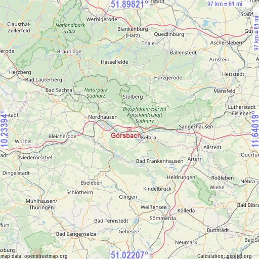
Görsbach GPS coordinates[2]
51° 27' 44.064" North, 10° 56' 13.416" East
| Map corner | latitude | longitude |
|---|---|---|
| Upper-left | 51.89821°, | 10.23394° |
| Center: | 51.46224°, | 10.93706° |
| Lower-right: | 51.02207°, | 11.64019° |
| Map W x H: | 97.4×97.4 km | = 60.5×60.5mi |
| max Lat: | 55.01917° ⇑34.2% North |
| Görsbach: | 51.46224° |
| min Lat: | ⇓65.8% South 47.40724° |
| min Long | Görsbach | max Long |
| 5.92978° | 10.93706° | 14.98853° |
| W 66.1%⇐ | ⇒33.9% E |
Elevation
Elevation of Görsbach is 164 m = 538 ft, and this is 85.1 m = 279 ft below average elevation for this country.
| Max E: |
1256 m = 4121 ft | 58.5% |
| Avg. | 249.1 m = 817 ft | |
| Görsbach | 164 m = 538 ft | |
Min E: |
-5 m = -16 ft | 41.5% |
See also: Germany elevation on elevation.city.
Geographical zone
Görsbach is located in North temperate zone (between Tropic of Cancer and the Arctic Circle). Distance of this North polar circle is 1679.1 km =1043.3 mi to North.| Distance of | km | miles | from Görsbach |
|---|---|---|---|
| North Pole | 4285 | 2662.6 | to North |
| Arctic Circle | 1679.1 | 1043.3 | to North |
| Tropic Cancer | 3116.1 | 1936.3 | to South |
| Equator | 5722.1 | 3555.5 | to South |


Nearby cities:
15 places around Görsbach: (largest is in red/bold)
• Auleben
4 km =2.5 mi,  187°
187°
• Badra
6.7 km =4.2 mi,  157°
157°
• Berga
4.9 km =3 mi,  98°
98°
• Breitungen
8.9 km =5.5 mi,  63°
63°
• Buchholz
9.3 km =5.8 mi,  328°
328°
• Heringen
4.5 km =2.8 mi,  248°
248°
• Kelbra
7.8 km =4.8 mi,  112°
112°
• Nordhausen
10.7 km =6.6 mi,  294°
294°
• Rottleberode
6.1 km =3.8 mi,  6°
6°
• Roßla
9.6 km =6 mi,  89°
89°
• Steinthaleben
9.6 km =6 mi,  140°
140°
• Uftrungen
5 km =3.1 mi,  36°
36°
• Urbach
3.2 km =2 mi,  308°
308°
• Uthleben
7 km =4.3 mi,  258°
258°
• Windehausen
4.5 km =2.8 mi,  275°
275°
Sources, notices
• [Note1] Compared only with cities in Germany existing in our database
• [Src1] Map data: © OpenStreetMap contributors (CC-BY-SA)
• [Src2] Other city data from geonames.org with taken over terms of usage.
• [Src3] Geographical zone / Annual Mean Temperature by Robert A. Rohde @ Wikipedia
