Auleben geodata
Auleben (Thuringia) is a populated place; located in Germany in Europe/Berlin (GMT+2) time zone. With population of 1,089 people, there are 6878 cities with bigger population in this country. Compared to other cities in Germany, 65.2% of cities are located further ↓South; 66% of cities are located further ←West and 57.4% of cities have higher elevation than Auleben. Note1
Administrative division(s):
- Level 1: Thuringia
- Level 3: Landkreis Nordhausen
- Level 4: Heringen/Helme


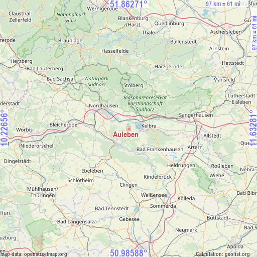
Auleben GPS coordinates[2]
51° 25' 35.04" North, 10° 55' 46.848" East
| Map corner | latitude | longitude |
|---|---|---|
| Upper-left | 51.86271°, | 10.22656° |
| Center: | 51.4264°, | 10.92968° |
| Lower-right: | 50.98588°, | 11.63281° |
| Map W x H: | 97.5×97.5 km | = 60.6×60.6mi |
| max Lat: | 55.01917° ⇑34.8% North |
| Auleben: | 51.4264° |
| min Lat: | ⇓65.2% South 47.40724° |
| min Long | Auleben | max Long |
| 5.92978° | 10.92968° | 14.98853° |
| W 66%⇐ | ⇒34% E |
Elevation
Elevation of Auleben is 172 m = 564 ft, and this is 77.1 m = 253 ft below average elevation for this country.
| Max E: |
1256 m = 4121 ft | 57.4% |
| Avg. | 249.1 m = 817 ft | |
| Auleben | 172 m = 564 ft | |
Min E: |
-5 m = -16 ft | 42.6% |
See also: Germany elevation on elevation.city.
Geographical zone
Auleben is located in North temperate zone (between Tropic of Cancer and the Arctic Circle). Distance of this North polar circle is 1683.1 km =1045.8 mi to North.| Distance of | km | miles | from Auleben |
|---|---|---|---|
| North Pole | 4289 | 2665.1 | to North |
| Arctic Circle | 1683.1 | 1045.8 | to North |
| Tropic Cancer | 3112.2 | 1933.8 | to South |
| Equator | 5718.1 | 3553.1 | to South |


Nearby cities:
15 places around Auleben: (largest is in red/bold)
• Badra
3.8 km =2.4 mi,  124°
124°
• Bendeleben
8 km =5 mi,  138°
138°
• Berga
6.3 km =3.9 mi,  58°
58°
• Görsbach
4 km =2.5 mi,  7°
7°
• Hachelbich
9.5 km =5.9 mi,  164°
164°
• Heringen
4.4 km =2.7 mi,  301°
301°
• Kelbra
7.8 km =4.8 mi,  82°
82°
• Rottleberode
10.1 km =6.3 mi, 6°
• Roßla
10.9 km =6.8 mi,  67°
67°
• Sondershausen
7.5 km =4.7 mi,  213°
213°
• Steinthaleben
7.5 km =4.7 mi, 117°
• Uftrungen
8.8 km =5.5 mi,  23°
23°
• Urbach
6.3 km =3.9 mi,  341°
341°
• Uthleben
6.8 km =4.2 mi,  291°
291°
• Windehausen
5.9 km =3.7 mi,  318°
318°
Sources, notices
• [Note1] Compared only with cities in Germany existing in our database
• [Src1] Map data: © OpenStreetMap contributors (CC-BY-SA)
• [Src2] Other city data from geonames.org with taken over terms of usage.
• [Src3] Geographical zone / Annual Mean Temperature by Robert A. Rohde @ Wikipedia
