Badra geodata
Badra (Thuringia) is a populated place; located in Germany in Europe/Berlin (GMT+2) time zone. With population of 625 people, there are 8687 cities with bigger population in this country. Compared to other cities in Germany, 64.9% of cities are located further ↓South; 66.7% of cities are located further ←West and 51.3% of cities have higher elevation than Badra. Note1


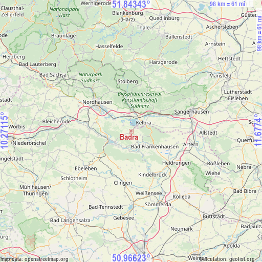
Badra GPS coordinates[2]
51° 24' 24.948" North, 10° 58' 27.372" East
| Map corner | latitude | longitude |
|---|---|---|
| Upper-left | 51.84343°, | 10.27115° |
| Center: | 51.40693°, | 10.97427° |
| Lower-right: | 50.96623°, | 11.6774° |
| Map W x H: | 97.5×97.5 km | = 60.6×60.6mi |
| max Lat: | 55.01917° ⇑35.1% North |
| Badra: | 51.40693° |
| min Lat: | ⇓64.9% South 47.40724° |
| min Long | Badra | max Long |
| 5.92978° | 10.97427° | 14.98853° |
| W 66.7%⇐ | ⇒33.3% E |
Elevation
Elevation of Badra is 216 m = 709 ft, and this is 33.1 m = 109 ft below average elevation for this country.
| Max E: |
1256 m = 4121 ft | 51.3% |
| Avg. | 249.1 m = 817 ft | |
| Badra | 216 m = 709 ft | |
Min E: |
-5 m = -16 ft | 48.7% |
See also: Germany elevation on elevation.city.
Geographical zone
Badra is located in North temperate zone (between Tropic of Cancer and the Arctic Circle). Distance of this North polar circle is 1685.3 km =1047.2 mi to North.| Distance of | km | miles | from Badra |
|---|---|---|---|
| North Pole | 4291.1 | 2666.4 | to North |
| Arctic Circle | 1685.3 | 1047.2 | to North |
| Tropic Cancer | 3110 | 1932.5 | to South |
| Equator | 5715.9 | 3551.7 | to South |


Nearby cities:
15 places around Badra: (largest is in red/bold)
• Auleben
3.8 km =2.4 mi,  304°
304°
• Bendeleben
4.4 km =2.7 mi,  149°
149°
• Berga
5.9 km =3.7 mi,  22°
22°
• Göllingen
7.6 km =4.7 mi,  158°
158°
• Görsbach
6.7 km =4.2 mi,  337°
337°
• Hachelbich
7 km =4.3 mi,  185°
185°
• Heringen
8.1 km =5 mi, 303°
• Kelbra
5.6 km =3.5 mi,  55°
55°
• Rottleben
7.1 km =4.4 mi,  134°
134°
• Roßla
9.4 km =5.8 mi,  48°
48°
• Sondershausen
8.3 km =5.2 mi,  240°
240°
• Steinthaleben
3.8 km =2.4 mi,  110°
110°
• Uftrungen
10.2 km =6.3 mi,  2°
2°
• Urbach
9.6 km =6 mi,  328°
328°
• Windehausen
9.6 km =6 mi,  312°
312°
Sources, notices
• [Note1] Compared only with cities in Germany existing in our database
• [Src1] Map data: © OpenStreetMap contributors (CC-BY-SA)
• [Src2] Other city data from geonames.org with taken over terms of usage.
• [Src3] Geographical zone / Annual Mean Temperature by Robert A. Rohde @ Wikipedia
