Oberellen geodata
Oberellen (Thuringia) is a populated place; located in Germany in Europe/Berlin (GMT+2) time zone. With population of 909 people, there are 7492 cities with bigger population in this country. Compared to other cities in Germany, 57.1% of cities are located further ↓South; 53.1% of cities are located further ←West and 53.2% of cities have lower elevation than Oberellen. Note1


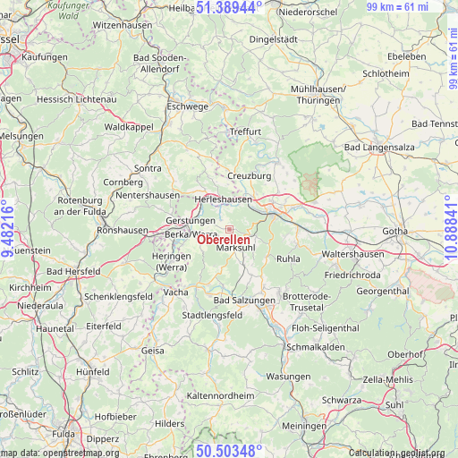
Oberellen GPS coordinates[2]
50° 56' 54.852" North, 10° 11' 7.008" East
| Map corner | latitude | longitude |
|---|---|---|
| Upper-left | 51.38944°, | 9.48216° |
| Center: | 50.94857°, | 10.18528° |
| Lower-right: | 50.50348°, | 10.88841° |
| Map W x H: | 98.5×98.5 km | = 61.2×61.2mi |
| max Lat: | 55.01917° ⇑42.9% North |
| Oberellen: | 50.94857° |
| min Lat: | ⇓57.1% South 47.40724° |
| min Long | Oberellen | max Long |
| 5.92978° | 10.18528° | 14.98853° |
| W 53.1%⇐ | ⇒46.9% E |
Elevation
Elevation of Oberellen is 248 m = 814 ft, and this is 1.1 m = 4 ft below average elevation for this country.
| Max E: |
1256 m = 4121 ft | 46.8% |
| Avg. | 249.1 m = 817 ft | |
| Oberellen | 248 m = 814 ft | |
Min E: |
-5 m = -16 ft | 53.2% |
See also: Germany elevation on elevation.city.
Geographical zone
Oberellen is located in North temperate zone (between Tropic of Cancer and the Arctic Circle). Distance of this North polar circle is 1736.2 km =1078.8 mi to North.| Distance of | km | miles | from Oberellen |
|---|---|---|---|
| North Pole | 4342.1 | 2698.1 | to North |
| Arctic Circle | 1736.2 | 1078.8 | to North |
| Tropic Cancer | 3059 | 1900.8 | to South |
| Equator | 5664.9 | 3520 | to South |


Nearby cities:
15 places around Oberellen: (largest is in red/bold)
• Creuzburg
12.4 km =7.7 mi,  20°
20°
• Dankmarshausen
12.1 km =7.5 mi,  257°
257°
• Dippach
10.5 km =6.5 mi,  252°
252°
• Eisenach
9.8 km =6.1 mi,  68°
68°
• Ettenhausen
8.3 km =5.2 mi,  156°
156°
• Frauensee
8.4 km =5.2 mi,  201°
201°
• Gerstungen
8.5 km =5.3 mi,  283°
283°
• Herleshausen
6.5 km =4 mi,  348°
348°
• Ifta
13.1 km =8.1 mi,  359°
359°
• Krauthausen
9.5 km =5.9 mi,  36°
36°
• Lauchröden
5.4 km =3.4 mi,  338°
338°
• Marksuhl
3.7 km =2.3 mi, 163°
• Tiefenort
12.2 km =7.6 mi,  186°
186°
• Unterellen
2.7 km =1.7 mi,  318°
318°
• Wolfsburg-Unkeroda
5.9 km =3.7 mi,  106°
106°
Sources, notices
• [Note1] Compared only with cities in Germany existing in our database
• [Src1] Map data: © OpenStreetMap contributors (CC-BY-SA)
• [Src2] Other city data from geonames.org with taken over terms of usage.
• [Src3] Geographical zone / Annual Mean Temperature by Robert A. Rohde @ Wikipedia
