Unterellen geodata
Unterellen (Thuringia) is a populated place; located in Germany in Europe/Berlin (GMT+2) time zone. With population of 561 people, there are 9021 cities with bigger population in this country. Compared to other cities in Germany, 57.4% of cities are located further ↓South; 52.6% of cities are located further ←West and 50.3% of cities have higher elevation than Unterellen. Note1


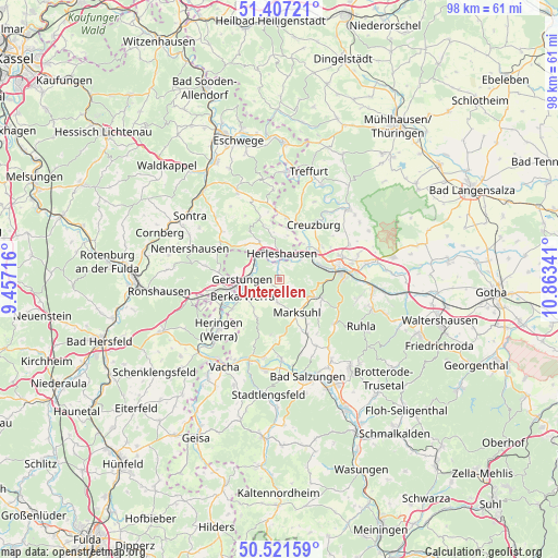
Unterellen GPS coordinates[2]
50° 57' 59.436" North, 10° 9' 37.008" East
| Map corner | latitude | longitude |
|---|---|---|
| Upper-left | 51.40721°, | 9.45716° |
| Center: | 50.96651°, | 10.16028° |
| Lower-right: | 50.52159°, | 10.86341° |
| Map W x H: | 98.5×98.5 km | = 61.2×61.2mi |
| max Lat: | 55.01917° ⇑42.6% North |
| Unterellen: | 50.96651° |
| min Lat: | ⇓57.4% South 47.40724° |
| min Long | Unterellen | max Long |
| 5.92978° | 10.16028° | 14.98853° |
| W 52.6%⇐ | ⇒47.4% E |
Elevation
Elevation of Unterellen is 223 m = 732 ft, and this is 26.1 m = 86 ft below average elevation for this country.
| Max E: |
1256 m = 4121 ft | 50.3% |
| Avg. | 249.1 m = 817 ft | |
| Unterellen | 223 m = 732 ft | |
Min E: |
-5 m = -16 ft | 49.7% |
See also: Germany elevation on elevation.city.
Geographical zone
Unterellen is located in North temperate zone (between Tropic of Cancer and the Arctic Circle). Distance of this North polar circle is 1734.2 km =1077.6 mi to North.| Distance of | km | miles | from Unterellen |
|---|---|---|---|
| North Pole | 4340.1 | 2696.8 | to North |
| Arctic Circle | 1734.2 | 1077.6 | to North |
| Tropic Cancer | 3061 | 1902 | to South |
| Equator | 5666.9 | 3521.2 | to South |


Nearby cities:
15 places around Unterellen: (largest is in red/bold)
• Creuzburg
11.4 km =7.1 mi,  32°
32°
• Dankmarshausen
11.1 km =6.9 mi,  245°
245°
• Dippach
9.8 km =6.1 mi,  237°
237°
• Eisenach
11 km =6.8 mi,  81°
81°
• Ettenhausen
10.9 km =6.8 mi,  152°
152°
• Frauensee
9.9 km =6.2 mi,  187°
187°
• Gerstungen
6.6 km =4.1 mi,  270°
270°
• Heringen
13.8 km =8.6 mi,  230°
230°
• Herleshausen
4.5 km =2.8 mi,  6°
6°
• Ifta
11.3 km =7 mi, 8°
• Krauthausen
9.3 km =5.8 mi,  53°
53°
• Lauchröden
3 km =1.9 mi,  355°
355°
• Marksuhl
6.2 km =3.9 mi, 153°
• Oberellen
2.7 km =1.7 mi,  138°
138°
• Wolfsburg-Unkeroda
8.3 km =5.2 mi,  116°
116°
Sources, notices
• [Note1] Compared only with cities in Germany existing in our database
• [Src1] Map data: © OpenStreetMap contributors (CC-BY-SA)
• [Src2] Other city data from geonames.org with taken over terms of usage.
• [Src3] Geographical zone / Annual Mean Temperature by Robert A. Rohde @ Wikipedia
