Coppenbrügge geodata
Coppenbrügge (Lower Saxony) is a populated place; located in Germany in Europe/Berlin (GMT+2) time zone. With population of 7,901 people, there are 1969 cities with bigger population in this country. Compared to other cities in Germany, 73.2% of cities are located further ↓South; 57.1% of cities are located further →East and 62.3% of cities have higher elevation than Coppenbrügge. Note1
Administrative division(s):
- Level 1: Lower Saxony
- Level 3: Landkreis Hameln-Pyrmont
- Level 4: Coppenbrügge, Flecken


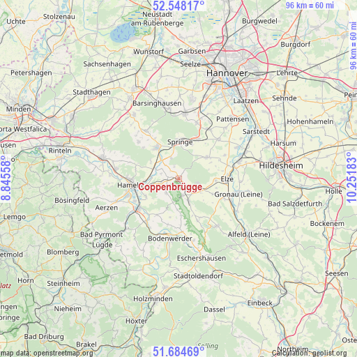
Coppenbrügge GPS coordinates[2]
52° 7' 6.672" North, 9° 32' 55.32" East
| Map corner | latitude | longitude |
|---|---|---|
| Upper-left | 52.54817°, | 8.84558° |
| Center: | 52.11852°, | 9.5487° |
| Lower-right: | 51.68469°, | 10.25183° |
| Map W x H: | 96×96 km | = 59.7×59.7mi |
| max Lat: | 55.01917° ⇑26.8% North |
| Coppenbrügge: | 52.11852° |
| min Lat: | ⇓73.2% South 47.40724° |
| min Long | Coppenbrügge | max Long |
| 5.92978° | 9.5487° | 14.98853° |
| W 42.9%⇐ | ⇒57.1% E |
Elevation
Elevation of Coppenbrügge is 136 m = 446 ft, and this is 113.1 m = 371 ft below average elevation for this country.
| Max E: |
1256 m = 4121 ft | 62.3% |
| Avg. | 249.1 m = 817 ft | |
| Coppenbrügge | 136 m = 446 ft | |
Min E: |
-5 m = -16 ft | 37.7% |
See also: Germany elevation on elevation.city.
Geographical zone
Coppenbrügge is located in North temperate zone (between Tropic of Cancer and the Arctic Circle). Distance of this North polar circle is 1606.1 km =998 mi to North.| Distance of | km | miles | from Coppenbrügge |
|---|---|---|---|
| North Pole | 4212 | 2617.2 | to North |
| Arctic Circle | 1606.1 | 998 | to North |
| Tropic Cancer | 3189.1 | 1981.6 | to South |
| Equator | 5795 | 3600.8 | to South |


Nearby cities:
15 places around Coppenbrügge: (largest is in red/bold)
• Bad Münder am Deister
10.3 km =6.4 mi,  326°
326°
• Banteln
14.9 km =9.3 mi,  112°
112°
• Duingen
16.2 km =10.1 mi,  141°
141°
• Eime
12.8 km =8 mi, 112°
• Elze
12.8 km =8 mi,  87°
87°
• Gronau
16 km =9.9 mi,  103°
103°
• Halle
14.2 km =8.8 mi,  175°
175°
• Hameln
13.2 km =8.2 mi,  262°
262°
• Hehlen
15.4 km =9.6 mi,  200°
200°
• Heinsen
10 km =6.2 mi,  128°
128°
• Heyen
12.5 km =7.8 mi,  194°
194°
• Marienhagen
13.1 km =8.1 mi, 133°
• Salzhemmendorf
6.3 km =3.9 mi,  155°
155°
• Springe
10 km =6.2 mi,  2°
2°
• Weenzen
12.4 km =7.7 mi, 139°
Sources, notices
• [Note1] Compared only with cities in Germany existing in our database
• [Src1] Map data: © OpenStreetMap contributors (CC-BY-SA)
• [Src2] Other city data from geonames.org with taken over terms of usage.
• [Src3] Geographical zone / Annual Mean Temperature by Robert A. Rohde @ Wikipedia
