el hed geodata
el hed (Béjaïa) is a populated place; located in Algeria in Africa/Algiers (GMT+1) time zone. With population of 31,890 people, there are 163 cities with bigger population in this country. Compared to other cities in Algeria, 81.4% of cities are located further ↓South; 67.8% of cities are located further ←West and 76.4% of cities have higher elevation than el hed. Note1


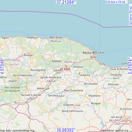
el hed GPS coordinates[2]
36° 39' 0" North, 4° 46' 24.996" East
| Map corner | latitude | longitude |
|---|---|---|
| Upper-left | 37.21204°, | 4.07049° |
| Center: | 36.65°, | 4.77361° |
| Lower-right: | 36.08382°, | 5.47674° |
| Map W x H: | 125.4×125.4 km | = 77.9×77.9mi |
| max Lat: | 36.92917° ⇑18.6% North |
| el hed: | 36.65° |
| min Lat: | ⇓81.4% South 22.785° |
| min Long | el hed | max Long |
| -8.14743° | 4.77361° | 8.46667° |
| W 67.8%⇐ | ⇒32.2% E |
Elevation
Elevation of el hed is 94 m = 308 ft, and this is 344.5 m = 1130 ft below average elevation for this country.
| Max E: |
1392 m = 4567 ft | 76.4% |
| Avg. | 438.5 m = 1439 ft | |
| el hed | 94 m = 308 ft | |
Min E: |
5 m = 16 ft | 23.6% |
See also: Algeria elevation on elevation.city.
Geographical zone
el hed is located in North temperate zone (between Tropic of Cancer and the Arctic Circle). Distance of this Northern Tropic circle is 1469.2 km =912.9 mi to South.| Distance of | km | miles | from el hed |
|---|---|---|---|
| North Pole | 5932 | 3686 | to North |
| Arctic Circle | 3326.1 | 2066.7 | to North |
| Tropic Cancer | 1469.2 | 912.9 | to South |
| Equator | 4075.1 | 2532.1 | to South |


Nearby cities:
15 places around el hed: (largest is in red/bold)
• Ait Yahia
39.7 km =24.7 mi,  260°
260°
• Akbou
30.2 km =18.8 mi,  224°
224°
• Amizour
11.4 km =7.1 mi,  95°
95°
• Arhribs
44.2 km =27.5 mi,  291°
291°
• Azazga
37.3 km =23.2 mi, 286°
• Barbacha
19.6 km =12.2 mi,  118°
118°
• Bejaïa
30.1 km =18.7 mi,  66°
66°
• Bordj Zemoura
42.4 km =26.3 mi,  169°
169°
• Chemini
15.1 km =9.4 mi,  248°
248°
• El Kseur
8 km =5 mi, 65°
• Feraoun
12.3 km =7.6 mi,  144°
144°
• Freha
42.4 km =26.3 mi, 285°
• Ighram
31.7 km =19.7 mi,  229°
229°
• Seddouk
13.8 km =8.6 mi,  214°
214°
• ’Aïn el Hammam
42.8 km =26.6 mi, 257°
Sources, notices
• [Note1] Compared only with cities in Algeria existing in our database
• [Src1] Map data: © OpenStreetMap contributors (CC-BY-SA)
• [Src2] Other city data from geonames.org with taken over terms of usage.
• [Src3] Geographical zone / Annual Mean Temperature by Robert A. Rohde @ Wikipedia
