Feraoun geodata
Feraoun (Béjaïa) is a populated place; located in Algeria in Africa/Algiers (GMT+1) time zone. With population of 21,700 people, there are 219 cities with bigger population in this country. Compared to other cities in Algeria, 73.3% of cities are located further ↓South; 68.2% of cities are located further ←West and 68.2% of cities have lower elevation than Feraoun. Note1


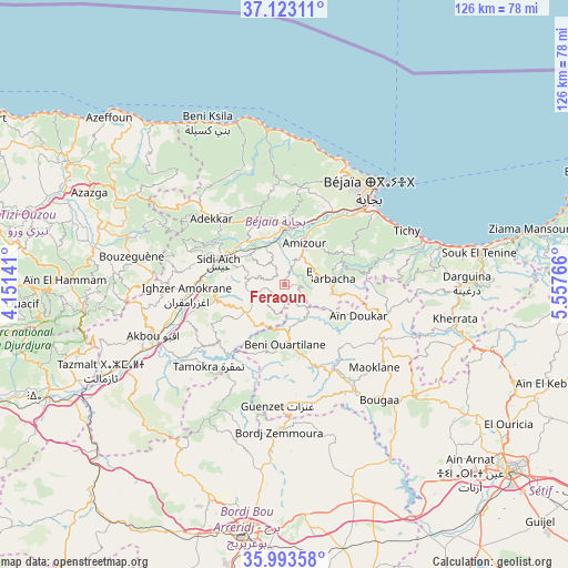
Feraoun GPS coordinates[2]
36° 33' 37.476" North, 4° 51' 16.344" East
| Map corner | latitude | longitude |
|---|---|---|
| Upper-left | 37.12311°, | 4.15141° |
| Center: | 36.56041°, | 4.85454° |
| Lower-right: | 35.99358°, | 5.55766° |
| Map W x H: | 125.6×125.6 km | = 78×78mi |
| max Lat: | 36.92917° ⇑26.7% North |
| Feraoun: | 36.56041° |
| min Lat: | ⇓73.3% South 22.785° |
| min Long | Feraoun | max Long |
| -8.14743° | 4.85454° | 8.46667° |
| W 68.2%⇐ | ⇒31.8% E |
Elevation
Elevation of Feraoun is 652 m = 2139 ft, and this is 213.5 m = 700 ft above average elevation for this country.
| Max E: |
1392 m = 4567 ft | 31.8% |
| Feraoun | 652 m 2139 ft | |
| Avg. | 438.5 m = 1439 ft | |
Min E: |
5 m = 16 ft | 68.2% |
See also: Algeria elevation on elevation.city.
Geographical zone
Feraoun is located in North temperate zone (between Tropic of Cancer and the Arctic Circle). Distance of this Northern Tropic circle is 1459.2 km =906.7 mi to South.| Distance of | km | miles | from Feraoun |
|---|---|---|---|
| North Pole | 5941.9 | 3692.1 | to North |
| Arctic Circle | 3336 | 2072.9 | to North |
| Tropic Cancer | 1459.2 | 906.7 | to South |
| Equator | 4065.1 | 2525.9 | to South |


Nearby cities:
15 places around Feraoun: (largest is in red/bold)
• Ait Yahia
46.5 km =28.9 mi,  273°
273°
• Akbou
30.8 km =19.1 mi,  248°
248°
• Amizour
9.8 km =6.1 mi,  25°
25°
• Azazga
47.7 km =29.6 mi,  295°
295°
• Barbacha
10 km =6.2 mi,  86°
86°
• Bejaïa
29.9 km =18.6 mi,  43°
43°
• Bordj Zemoura
31.8 km =19.8 mi,  179°
179°
• Bougaa
32.8 km =20.4 mi,  140°
140°
• Chemini
21.7 km =13.5 mi,  281°
281°
• Chorfa
52 km =32.3 mi, 245°
• El Kseur
13.2 km =8.2 mi,  0°
0°
• Ighram
33 km =20.5 mi, 250°
• Seddouk
15.1 km =9.4 mi,  264°
264°
• el hed
12.3 km =7.6 mi,  324°
324°
• ’Aïn el Hammam
49 km =30.4 mi, 270°
Sources, notices
• [Note1] Compared only with cities in Algeria existing in our database
• [Src1] Map data: © OpenStreetMap contributors (CC-BY-SA)
• [Src2] Other city data from geonames.org with taken over terms of usage.
• [Src3] Geographical zone / Annual Mean Temperature by Robert A. Rohde @ Wikipedia
