Cheraga geodata
Cheraga (Tipaza) is a populated place; located in Algeria in Africa/Algiers (GMT+1) time zone. With population of 27,835 people, there are 185 cities with bigger population in this country. Compared to other cities in Algeria, 93.8% of cities are located further ↓South; 60.5% of cities are located further →East and 60.9% of cities have higher elevation than Cheraga. Note1


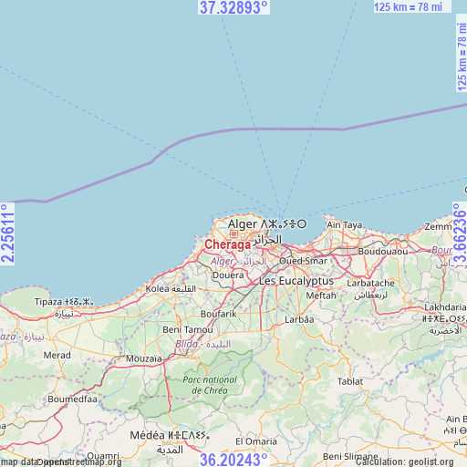
Cheraga GPS coordinates[2]
36° 46' 3.9" North, 2° 57' 33.264" East
| Map corner | latitude | longitude |
|---|---|---|
| Upper-left | 37.32893°, | 2.25611° |
| Center: | 36.76775°, | 2.95924° |
| Lower-right: | 36.20243°, | 3.66236° |
| Map W x H: | 125.3×125.3 km | = 77.9×77.9mi |
| max Lat: | 36.92917° ⇑6.2% North |
| Cheraga: | 36.76775° |
| min Lat: | ⇓93.8% South 22.785° |
| min Long | Cheraga | max Long |
| -8.14743° | 2.95924° | 8.46667° |
| W 39.5%⇐ | ⇒60.5% E |
Elevation
Elevation of Cheraga is 171 m = 561 ft, and this is 267.5 m = 878 ft below average elevation for this country.
| Max E: |
1392 m = 4567 ft | 60.9% |
| Avg. | 438.5 m = 1439 ft | |
| Cheraga | 171 m = 561 ft | |
Min E: |
5 m = 16 ft | 39.1% |
See also: Algeria elevation on elevation.city.
Geographical zone
Cheraga is located in North temperate zone (between Tropic of Cancer and the Arctic Circle). Distance of this Northern Tropic circle is 1482.3 km =921.1 mi to South.| Distance of | km | miles | from Cheraga |
|---|---|---|---|
| North Pole | 5918.9 | 3677.8 | to North |
| Arctic Circle | 3313 | 2058.6 | to North |
| Tropic Cancer | 1482.3 | 921.1 | to South |
| Equator | 4088.2 | 2540.3 | to South |


Nearby cities:
15 places around Cheraga: (largest is in red/bold)
• Algiers
12.1 km =7.5 mi,  109°
109°
• Bab Ezzouar
20.5 km =12.7 mi,  103°
103°
• Baraki
16.6 km =10.3 mi,  132°
132°
• Birkhadem
10 km =6.2 mi, 125°
• Bordj el Kiffan
20.9 km =13 mi, 95°
• Boufarik
21.9 km =13.6 mi,  191°
191°
• Bouinan
26.4 km =16.4 mi,  173°
173°
• Chebli
21.6 km =13.4 mi, 168°
• Dar el Beïda
23.4 km =14.5 mi, 105°
• Douera
10.9 km =6.8 mi, 186°
• Kolea
22.2 km =13.8 mi,  229°
229°
• Saoula
9.1 km =5.7 mi,  140°
140°
• Sidi Moussa
21.3 km =13.2 mi,  147°
147°
• Zeralda
12.1 km =7.5 mi,  239°
239°
• ’Aïn Benian
5.1 km =3.2 mi,  319°
319°
Sources, notices
• [Note1] Compared only with cities in Algeria existing in our database
• [Src1] Map data: © OpenStreetMap contributors (CC-BY-SA)
• [Src2] Other city data from geonames.org with taken over terms of usage.
• [Src3] Geographical zone / Annual Mean Temperature by Robert A. Rohde @ Wikipedia
