’Aïn Benian geodata
’Aïn Benian (Tipaza) is a populated place; located in Algeria in Africa/Algiers (GMT+1) time zone. With population of 31,102 people, there are 166 cities with bigger population in this country. Compared to other cities in Algeria, 96.5% of cities are located further ↓South; 61.2% of cities are located further →East and 92.2% of cities have higher elevation than ’Aïn Benian. Note1


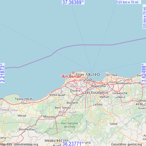
’Aïn Benian GPS coordinates[2]
36° 48' 9.972" North, 2° 55' 18.66" East
| Map corner | latitude | longitude |
|---|---|---|
| Upper-left | 37.36369°, | 2.21873° |
| Center: | 36.80277°, | 2.92185° |
| Lower-right: | 36.23771°, | 3.62498° |
| Map W x H: | 125.2×125.2 km | = 77.8×77.8mi |
| max Lat: | 36.92917° ⇑3.5% North |
| ’Aïn Benian: | 36.80277° |
| min Lat: | ⇓96.5% South 22.785° |
| min Long | ’Aïn Benian | max Long |
| -8.14743° | 2.92185° | 8.46667° |
| W 38.8%⇐ | ⇒61.2% E |
Elevation
Elevation of ’Aïn Benian is 30 m = 98 ft, and this is 408.5 m = 1340 ft below average elevation for this country.
| Max E: |
1392 m = 4567 ft | 92.2% |
| Avg. | 438.5 m = 1439 ft | |
| ’Aïn Benian | 30 m = 98 ft | |
Min E: |
5 m = 16 ft | 7.8% |
See also: Algeria elevation on elevation.city.
Geographical zone
’Aïn Benian is located in North temperate zone (between Tropic of Cancer and the Arctic Circle). Distance of this Northern Tropic circle is 1486.2 km =923.5 mi to South.| Distance of | km | miles | from ’Aïn Benian |
|---|---|---|---|
| North Pole | 5915 | 3675.4 | to North |
| Arctic Circle | 3309.1 | 2056.2 | to North |
| Tropic Cancer | 1486.2 | 923.5 | to South |
| Equator | 4092.1 | 2542.7 | to South |


Nearby cities:
15 places around ’Aïn Benian: (largest is in red/bold)
• Algiers
16.7 km =10.4 mi,  117°
117°
• Bab Ezzouar
24.8 km =15.4 mi,  110°
110°
• Baraki
21.7 km =13.5 mi,  134°
134°
• Birkhadem
15 km =9.3 mi, 130°
• Bordj el Kiffan
24.8 km =15.4 mi,  104°
104°
• Bou Ismaïl
27.3 km =17 mi,  229°
229°
• Boufarik
25.4 km =15.8 mi,  181°
181°
• Chebli
26.3 km =16.3 mi,  162°
162°
• Cheraga
5.1 km =3.2 mi,  139°
139°
• Dar el Beïda
27.7 km =17.2 mi, 111°
• Douera
14.9 km =9.3 mi,  172°
172°
• Kolea
22.8 km =14.2 mi,  216°
216°
• Saoula
14.3 km =8.9 mi, 140°
• Sidi Moussa
26.4 km =16.4 mi,  145°
145°
• Zeralda
12.4 km =7.7 mi,  214°
214°
Sources, notices
• [Note1] Compared only with cities in Algeria existing in our database
• [Src1] Map data: © OpenStreetMap contributors (CC-BY-SA)
• [Src2] Other city data from geonames.org with taken over terms of usage.
• [Src3] Geographical zone / Annual Mean Temperature by Robert A. Rohde @ Wikipedia
