Montalvo geodata
Montalvo (Pastaza) is a seat of a third-order administrative division; located in Ecuador in America/Guayaquil (GMT-5) time zone. In our database, there are 114 cities with bigger population. Compared to other cities in Ecuador, 65.3% of cities are located further ↑North; 98.3% of cities are located further ←West and 53.7% of cities have lower elevation than Montalvo. Note1


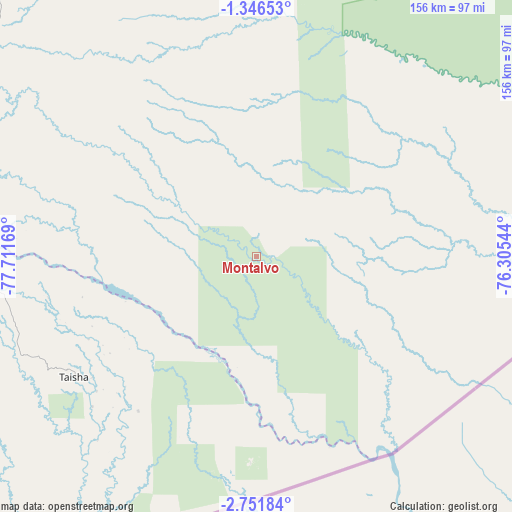
Montalvo GPS coordinates[2]
2° 2' 57.624" South, 77° 0' 30.816" West
| Map corner | latitude | longitude |
|---|---|---|
| Upper-left | -1.34653°, | -77.71169° |
| Center: | -2.04934°, | -77.00856° |
| Lower-right: | -2.75184°, | -76.30544° |
| Map W x H: | 156.3×156.3 km | = 97.1×97.1mi |
| max Lat: | 1.35251° ⇑65.3% North |
| Montalvo: | -2.04934° |
| min Lat: | ⇓34.7% South -4.38181° |
| min Long | Montalvo | max Long |
| -90.96654° | -77.00856° | -76.89528° |
| W 98.3%⇐ | ⇒1.7% E |
Elevation
Elevation of Montalvo is 316 m = 1037 ft, and this is 629.1 m = 2064 ft below average elevation for this country.
| Max E: |
3131 m = 10272 ft | 46.3% |
| Avg. | 945.1 m = 3101 ft | |
| Montalvo | 316 m = 1037 ft | |
Min E: |
1 m = 3 ft | 53.7% |
See also: Ecuador elevation on elevation.city.
Geographical zone
Montalvo is located in South Torrid zone (between Equator and Tropic of Capricorn). Distance of Equator is 227.9 km =141.6 mi to North.| Distance of | km | miles | from Montalvo |
|---|---|---|---|
| Equator | 227.9 | 141.6 | to North |
| Tropic Capricorn | 2378.1 | 1477.7 | to South |
| Antarctic Circle | 7173.3 | 4457.3 | to South |
| South Pole | 9779.2 | 6076.5 | to South |


Nearby cities:
15 places around Montalvo: (largest is in red/bold)
• Archidona
154.8 km =96.2 mi,  324°
324°
• Baños
173.1 km =107.6 mi,  294°
294°
• Boca Suno
150.9 km =93.8 mi,  354°
354°
• Guano
186.9 km =116.1 mi, 285°
• Macas
125.9 km =78.2 mi,  256°
256°
• Palora
113.1 km =70.3 mi, 290°
• Pelileo
188.4 km =117.1 mi,  295°
295°
• Puerto Francisco de Orellana
176 km =109.4 mi,  0°
0°
• Puyo
127.1 km =79 mi, 299°
• Quero
192.7 km =119.7 mi, 292°
• Riobamba
186.9 km =116.1 mi,  283°
283°
• Santa Clara
131 km =81.4 mi,  311°
311°
• Sucúa
137 km =85.1 mi,  250°
250°
• Taisha
59.7 km =37.1 mi,  237°
237°
• Tena
147.5 km =91.7 mi, 322°
Sources, notices
• [Note1] Compared only with cities in Ecuador existing in our database
• [Src1] Map data: © OpenStreetMap contributors (CC-BY-SA)
• [Src2] Other city data from geonames.org with taken over terms of usage.
• [Src3] Geographical zone / Annual Mean Temperature by Robert A. Rohde @ Wikipedia
