Boca Suno geodata
Boca Suno (Orellana) is a populated place; located in Ecuador in America/Guayaquil (GMT-5) time zone. With population of 20,313 people, there are 50 cities with bigger population in this country. Compared to other cities in Ecuador, 76% of cities are located further ↓South; 97.5% of cities are located further ←West and 51.2% of cities have lower elevation than Boca Suno. Note1


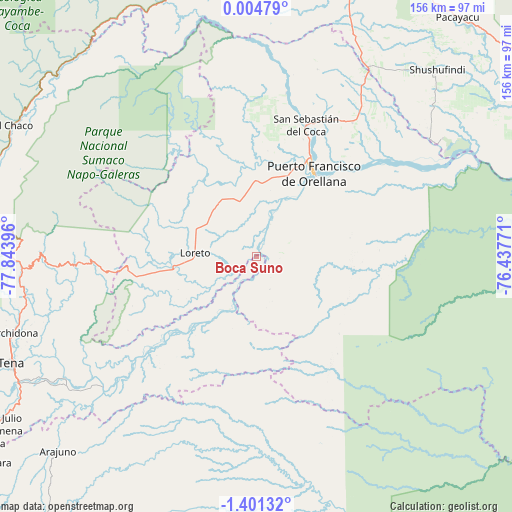
Boca Suno GPS coordinates[2]
0° 41' 53.952" South, 77° 8' 26.988" West
| Map corner | latitude | longitude |
|---|---|---|
| Upper-left | 0.00479°, | -77.84396° |
| Center: | -0.69832°, | -77.14083° |
| Lower-right: | -1.40132°, | -76.43771° |
| Map W x H: | 156.3×156.3 km | = 97.1×97.1mi |
| max Lat: | 1.35251° ⇑24% North |
| Boca Suno: | -0.69832° |
| min Lat: | ⇓76% South -4.38181° |
| min Long | Boca Suno | max Long |
| -90.96654° | -77.14083° | -76.89528° |
| W 97.5%⇐ | ⇒2.5% E |
Elevation
Elevation of Boca Suno is 280 m = 919 ft, and this is 665.1 m = 2182 ft below average elevation for this country.
| Max E: |
3131 m = 10272 ft | 48.8% |
| Avg. | 945.1 m = 3101 ft | |
| Boca Suno | 280 m = 919 ft | |
Min E: |
1 m = 3 ft | 51.2% |
See also: Ecuador elevation on elevation.city.
Geographical zone
Boca Suno is located in South Torrid zone (between Equator and Tropic of Capricorn). Distance of Equator is 77.6 km =48.2 mi to North.| Distance of | km | miles | from Boca Suno |
|---|---|---|---|
| Equator | 77.6 | 48.2 | to North |
| Tropic Capricorn | 2528.3 | 1571 | to South |
| Antarctic Circle | 7323.5 | 4550.6 | to South |
| South Pole | 9929.4 | 6169.8 | to South |


Nearby cities:
15 places around Boca Suno: (largest is in red/bold)
• Archidona
77.8 km =48.3 mi,  252°
252°
• Cayambe
138.7 km =86.2 mi,  306°
306°
• Gonzalo Pizarro
83.8 km =52.1 mi,  341°
341°
• Ibarra
159.8 km =99.3 mi,  316°
316°
• Machachi
160 km =99.4 mi,  277°
277°
• Montalvo
150.9 km =93.8 mi,  174°
174°
• Nueva Loja
91.4 km =56.8 mi,  17°
17°
• Palora
144.3 km =89.7 mi,  219°
219°
• Pimampiro
150.3 km =93.4 mi, 323°
• Puerto Francisco de Orellana
30.9 km =19.2 mi,  33°
33°
• Puyo
129.6 km =80.5 mi,  227°
227°
• Sangolquí
151.3 km =94 mi,  285°
285°
• Santa Clara
104.1 km =64.7 mi, 232°
• Tena
81.6 km =50.7 mi, 246°
• Tutamandahostel
160.8 km =99.9 mi, 290°
Sources, notices
• [Note1] Compared only with cities in Ecuador existing in our database
• [Src1] Map data: © OpenStreetMap contributors (CC-BY-SA)
• [Src2] Other city data from geonames.org with taken over terms of usage.
• [Src3] Geographical zone / Annual Mean Temperature by Robert A. Rohde @ Wikipedia
