Esmeraldas geodata
Esmeraldas is a seat of a first-order administrative division; located in Ecuador in America/Guayaquil (GMT-5) time zone. With population of 165,216 people, there are 8 cities with bigger population in this country. Compared to other cities in Ecuador, 97.5% of cities are located further ↓South; 62% of cities are located further →East and 76% of cities have higher elevation than Esmeraldas. Note1


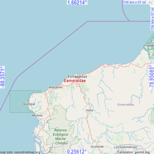
Esmeraldas GPS coordinates[2]
0° 57' 33.12" North, 79° 39' 14.292" West
| Map corner | latitude | longitude |
|---|---|---|
| Upper-left | 1.66214°, | -80.3571° |
| Center: | 0.9592°, | -79.65397° |
| Lower-right: | 0.25612°, | -78.95085° |
| Map W x H: | 156.3×156.3 km | = 97.1×97.1mi |
| max Lat: | 1.35251° ⇑2.5% North |
| Esmeraldas: | 0.9592° |
| min Lat: | ⇓97.5% South -4.38181° |
| min Long | Esmeraldas | max Long |
| -90.96654° | -79.65397° | -76.89528° |
| W 38%⇐ | ⇒62% E |
Elevation
Elevation of Esmeraldas is 18 m = 59 ft, and this is 927.1 m = 3042 ft below average elevation for this country.
| Max E: |
3131 m = 10272 ft | 76% |
| Avg. | 945.1 m = 3101 ft | |
| Esmeraldas | 18 m = 59 ft | |
Min E: |
1 m = 3 ft | 24% |
See also: Esmeraldas elevation on elevation.city.
Geographical zone
Esmeraldas is located in North Torrid zone (between Equator and Tropic of Cancer). Distance of Equator is 106.7 km =66.3 mi to South.| Distance of | km | miles | from Esmeraldas |
|---|---|---|---|
| North Pole | 9900.4 | 6151.8 | to North |
| Arctic Circle | 7294.5 | 4532.6 | to North |
| Tropic Cancer | 2499.3 | 1553 | to North |
| Equator | 106.7 | 66.3 | to South |


Nearby cities:
15 places around Esmeraldas: (largest is in red/bold)
• Atuntaqui
174.6 km =108.5 mi,  113°
113°
• Cotacachi
171 km =106.3 mi,  115°
115°
• Cube
42.9 km =26.7 mi,  178°
178°
• Ibarra
183.2 km =113.8 mi, 111°
• Muisne
56 km =34.8 mi,  226°
226°
• Otavalo
174.4 km =108.4 mi, 117°
• Pampanal de Bolívar
95.2 km =59.2 mi,  62°
62°
• Pedernales
108.2 km =67.2 mi,  204°
204°
• Quito
182.3 km =113.3 mi,  136°
136°
• Rosa Zarate
73 km =45.4 mi,  164°
164°
• San Lorenzo de Esmeraldas
98 km =60.9 mi,  68°
68°
• Santo Domingo de los Colorados
144.9 km =90 mi, 158°
• Tutamandahostel
181.8 km =113 mi, 135°
• Valdez
81.3 km =50.5 mi, 66°
• Wilfrido Loor Moreira
145.9 km =90.7 mi, 180°
Sources, notices
• [Note1] Compared only with cities in Ecuador existing in our database
• [Src1] Map data: © OpenStreetMap contributors (CC-BY-SA)
• [Src2] Other city data from geonames.org with taken over terms of usage.
• [Src3] Geographical zone / Annual Mean Temperature by Robert A. Rohde @ Wikipedia
