Valdez geodata
Valdez (Esmeraldas) is a populated place; located in Ecuador in America/Guayaquil (GMT-5) time zone. With population of 11,441 people, there are 78 cities with bigger population in this country. Compared to other cities in Ecuador, 98.3% of cities are located further ↓South; 59.5% of cities are located further ←West and 95.9% of cities have higher elevation than Valdez. Note1
Administrative division(s):
- Level 1: Esmeraldas
- Level 2: Cantón Eloy Alfaro
- Level 3: Valdez (Limones)


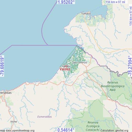
Valdez GPS coordinates[2]
1° 14' 57.012" North, 78° 58' 59.016" West
| Map corner | latitude | longitude |
|---|---|---|
| Upper-left | 1.95202°, | -79.68619° |
| Center: | 1.24917°, | -78.98306° |
| Lower-right: | 0.54614°, | -78.27994° |
| Map W x H: | 156.3×156.3 km | = 97.1×97.1mi |
| max Lat: | 1.35251° ⇑1.7% North |
| Valdez: | 1.24917° |
| min Lat: | ⇓98.3% South -4.38181° |
| min Long | Valdez | max Long |
| -90.96654° | -78.98306° | -76.89528° |
| W 59.5%⇐ | ⇒40.5% E |
Elevation
Elevation of Valdez is 7 m = 23 ft, and this is 938.1 m = 3078 ft below average elevation for this country.
| Max E: |
3131 m = 10272 ft | 95.9% |
| Avg. | 945.1 m = 3101 ft | |
| Valdez | 7 m = 23 ft | |
Min E: |
1 m = 3 ft | 4.1% |
See also: Ecuador elevation on elevation.city.
Geographical zone
Valdez is located in North Torrid zone (between Equator and Tropic of Cancer). Distance of Equator is 138.9 km =86.3 mi to South.| Distance of | km | miles | from Valdez |
|---|---|---|---|
| North Pole | 9868.2 | 6131.8 | to North |
| Arctic Circle | 7262.3 | 4512.6 | to North |
| Tropic Cancer | 2467 | 1532.9 | to North |
| Equator | 138.9 | 86.3 | to South |


Nearby cities:
15 places around Valdez: (largest is in red/bold)
• Atuntaqui
133.1 km =82.7 mi,  139°
139°
• Cayambe
163.5 km =101.6 mi,  145°
145°
• Cotacachi
132.3 km =82.2 mi, 142°
• Cube
105.1 km =65.3 mi,  224°
224°
• El Ángel
135.3 km =84.1 mi,  120°
120°
• Esmeraldas
81.3 km =50.5 mi,  246°
246°
• Ibarra
138.3 km =85.9 mi, 136°
• Muisne
135.2 km =84 mi,  238°
238°
• Otavalo
138.4 km =86 mi, 144°
• Pampanal de Bolívar
15.2 km =9.4 mi,  40°
40°
• Pimampiro
150.1 km =93.3 mi,  129°
129°
• Rosa Zarate
116.1 km =72.1 mi,  208°
208°
• San Gabriel
147.4 km =91.6 mi, 119°
• San Lorenzo de Esmeraldas
17 km =10.6 mi,  75°
75°
• Tulcán
148.9 km =92.5 mi,  109°
109°
Sources, notices
• [Note1] Compared only with cities in Ecuador existing in our database
• [Src1] Map data: © OpenStreetMap contributors (CC-BY-SA)
• [Src2] Other city data from geonames.org with taken over terms of usage.
• [Src3] Geographical zone / Annual Mean Temperature by Robert A. Rohde @ Wikipedia
