Baláo geodata
Baláo (Guayas) is a populated place; located in Ecuador in America/Guayaquil (GMT-5) time zone. With population of 12,205 people, there are 77 cities with bigger population in this country. Compared to other cities in Ecuador, 85.1% of cities are located further ↑North; 69.4% of cities are located further →East and 98.3% of cities have higher elevation than Baláo. Note1


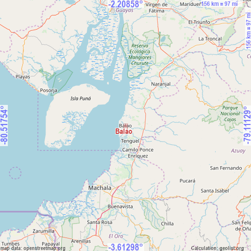
Baláo GPS coordinates[2]
2° 54' 39.6" South, 79° 48' 51.876" West
| Map corner | latitude | longitude |
|---|---|---|
| Upper-left | -2.20858°, | -80.51754° |
| Center: | -2.911°, | -79.81441° |
| Lower-right: | -3.61298°, | -79.11129° |
| Map W x H: | 156.2×156.2 km | = 97.1×97.1mi |
| max Lat: | 1.35251° ⇑85.1% North |
| Baláo: | -2.911° |
| min Lat: | ⇓14.9% South -4.38181° |
| min Long | Baláo | max Long |
| -90.96654° | -79.81441° | -76.89528° |
| W 30.6%⇐ | ⇒69.4% E |
Elevation
Elevation of Baláo is 5 m = 16 ft, and this is 940.1 m = 3084 ft below average elevation for this country.
| Max E: |
3131 m = 10272 ft | 98.3% |
| Avg. | 945.1 m = 3101 ft | |
| Baláo | 5 m = 16 ft | |
Min E: |
1 m = 3 ft | 1.7% |
See also: Ecuador elevation on elevation.city.
Geographical zone
Baláo is located in South Torrid zone (between Equator and Tropic of Capricorn). Distance of Equator is 323.7 km =201.1 mi to North.| Distance of | km | miles | from Baláo |
|---|---|---|---|
| Equator | 323.7 | 201.1 | to North |
| Tropic Capricorn | 2282.2 | 1418.1 | to South |
| Antarctic Circle | 7077.5 | 4397.8 | to South |
| South Pole | 9683.4 | 6017 | to South |


Nearby cities:
15 places around Baláo: (largest is in red/bold)
• Coronel Marcelino Maridueña
88.8 km =55.2 mi,  28°
28°
• Eloy Alfaro
81.9 km =50.9 mi,  356°
356°
• Guayaquil
79.9 km =49.6 mi,  354°
354°
• Huaquillas
77.9 km =48.4 mi,  216°
216°
• La Troncal
75.6 km =47 mi,  44°
44°
• Machala
41.9 km =26 mi,  202°
202°
• Milagro
89.8 km =55.8 mi,  15°
15°
• Naranjal
34.2 km =21.3 mi, 39°
• Pasaje
46.1 km =28.6 mi,  178°
178°
• Piñas
86.9 km =54 mi,  170°
170°
• Playas
70.9 km =44.1 mi,  295°
295°
• Puerto Bolívar
44.4 km =27.6 mi,  207°
207°
• Santa Lucía
83.5 km =51.9 mi, 345°
• Santa Rosa
61.9 km =38.5 mi, 195°
• Zaruma
89.6 km =55.7 mi, 165°
Sources, notices
• [Note1] Compared only with cities in Ecuador existing in our database
• [Src1] Map data: © OpenStreetMap contributors (CC-BY-SA)
• [Src2] Other city data from geonames.org with taken over terms of usage.
• [Src3] Geographical zone / Annual Mean Temperature by Robert A. Rohde @ Wikipedia
