Abu Simbel geodata
Abu Simbel (Aswan) is a populated place; located in Egypt in Africa/Cairo (GMT+2) time zone. With population of 5,000 people, there are 128 cities with bigger population in this country. Compared to other cities in Egypt, 100% of cities are located further ↑North; 64.5% of cities are located further ←West and 98.6% of cities have lower elevation than Abu Simbel. Note1


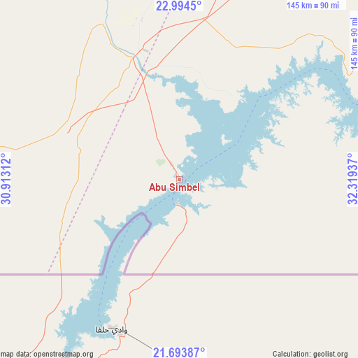
Abu Simbel GPS coordinates[2]
22° 20' 44.52" North, 31° 36' 58.464" East
| Map corner | latitude | longitude |
|---|---|---|
| Upper-left | 22.9945°, | 30.91312° |
| Center: | 22.3457°, | 31.61624° |
| Lower-right: | 21.69387°, | 32.31937° |
| Map W x H: | 144.6×144.6 km | = 89.9×89.9mi |
| max Lat: | 31.5084° ⇑100% North |
| Abu Simbel: | 22.3457° |
| min Lat: | ⇓0% South 22.3457° |
| min Long | Abu Simbel | max Long |
| 25.51965° | 31.61624° | 34.89572° |
| W 64.5%⇐ | ⇒35.5% E |
Elevation
Elevation of Abu Simbel is 189 m = 620 ft, and this is 145.5 m = 477 ft above average elevation for this country.
| Max E: |
1565 m = 5135 ft | 1.4% |
| Abu Simbel | 189 m 620 ft | |
| Avg. | 43.5 m = 143 ft | |
Min E: |
-15 m = -49 ft | 98.6% |
See also: Egypt elevation on elevation.city.
Geographical zone
Abu Simbel is located in North Torrid zone (between Equator and Tropic of Cancer). Distance of this Northern Tropic circle is 121.3 km =75.4 mi to North.| Distance of | km | miles | from Abu Simbel |
|---|---|---|---|
| North Pole | 7522.5 | 4674.3 | to North |
| Arctic Circle | 4916.6 | 3055 | to North |
| Tropic Cancer | 121.3 | 75.4 | to North |
| Equator | 2484.6 | 1543.9 | to South |


Nearby cities:
12 places around Abu Simbel: (largest is in red/bold)
• Al Balyanā
434.3 km =269.9 mi,  5°
5°
• Al Khārijah
362 km =224.9 mi,  342°
342°
• Aswan
234.2 km =145.5 mi,  34°
34°
• Dishnā
429.1 km =266.6 mi, 11°
• Farshūţ
416.1 km =258.6 mi, 7°
• Idfū
319.7 km =198.7 mi,  23°
23°
• Isnā
341.3 km =212.1 mi, 16°
• Kawm Umbū
273 km =169.6 mi, 29°
• Kousa
413.6 km =257 mi, 16°
• Luxor
387.1 km =240.5 mi, 15°
• Naja' Ḥammādī
416.7 km =258.9 mi, 8°
• Qinā
439.2 km =272.9 mi, 14°
Sources, notices
• [Note1] Compared only with cities in Egypt existing in our database
• [Src1] Map data: © OpenStreetMap contributors (CC-BY-SA)
• [Src2] Other city data from geonames.org with taken over terms of usage.
• [Src3] Geographical zone / Annual Mean Temperature by Robert A. Rohde @ Wikipedia
