Qinā geodata
Qinā (Qena) is a seat of a first-order administrative division; located in Egypt in Africa/Cairo (GMT+2) time zone. With population of 235,362 people, there are 15 cities with bigger population in this country. Compared to other cities in Egypt, 90.6% of cities are located further ↑North; 84.8% of cities are located further ←West and 91.3% of cities have lower elevation than Qinā. Note1


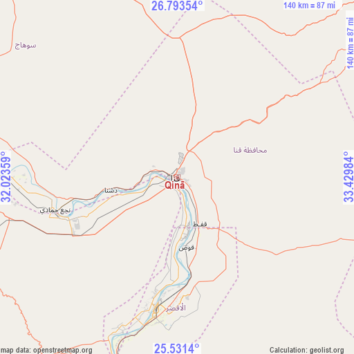
Qinā GPS coordinates[2]
26° 9' 51.048" North, 32° 43' 36.156" East
| Map corner | latitude | longitude |
|---|---|---|
| Upper-left | 26.79354°, | 32.02359° |
| Center: | 26.16418°, | 32.72671° |
| Lower-right: | 25.5314°, | 33.42984° |
| Map W x H: | 140.3×140.3 km | = 87.2×87.2mi |
| max Lat: | 31.5084° ⇑90.6% North |
| Qinā: | 26.16418° |
| min Lat: | ⇓9.4% South 22.3457° |
| min Long | Qinā | max Long |
| 25.51965° | 32.72671° | 34.89572° |
| W 84.8%⇐ | ⇒15.2% E |
Elevation
Elevation of Qinā is 80 m = 262 ft, and this is 36.5 m = 120 ft above average elevation for this country.
| Max E: |
1565 m = 5135 ft | 8.7% |
| Qinā | 80 m 262 ft | |
| Avg. | 43.5 m = 143 ft | |
Min E: |
-15 m = -49 ft | 91.3% |
See also: Qinā elevation on elevation.city.
Geographical zone
Qinā is located in North temperate zone (between Tropic of Cancer and the Arctic Circle). Distance of this Northern Tropic circle is 303.3 km =188.5 mi to South.| Distance of | km | miles | from Qinā |
|---|---|---|---|
| North Pole | 7097.9 | 4410.4 | to North |
| Arctic Circle | 4492 | 2791.2 | to North |
| Tropic Cancer | 303.3 | 188.5 | to South |
| Equator | 2909.2 | 1807.7 | to South |


Nearby cities:
15 places around Qinā: (largest is in red/bold)
• Akhmīm
107.3 km =66.7 mi,  294°
294°
• Al Balyanā
72.6 km =45.1 mi,  276°
276°
• Al Manshāh
98.4 km =61.1 mi, 290°
• Dishnā
25.4 km =15.8 mi,  260°
260°
• Farshūţ
57.5 km =35.7 mi, 257°
• Idfū
132.6 km =82.4 mi,  173°
173°
• Isnā
98.4 km =61.1 mi,  190°
190°
• Jirjā
85.5 km =53.1 mi, 283°
• Juhaynah
134.8 km =83.8 mi, 294°
• Kousa
27.9 km =17.3 mi, 172°
• Luxor
52.4 km =32.6 mi, 189°
• Naja' Ḥammādī
50.1 km =31.1 mi, 255°
• Safaga
137.1 km =85.2 mi,  61°
61°
• Sohag
111.7 km =69.4 mi, 293°
• Ţahţā
139.2 km =86.5 mi,  298°
298°
Sources, notices
• [Note1] Compared only with cities in Egypt existing in our database
• [Src1] Map data: © OpenStreetMap contributors (CC-BY-SA)
• [Src2] Other city data from geonames.org with taken over terms of usage.
• [Src3] Geographical zone / Annual Mean Temperature by Robert A. Rohde @ Wikipedia
