Bi’r al ‘Abd geodata
Bi’r al ‘Abd (North Sinai) is a seat of a second-order administrative division; located in Egypt in Africa/Cairo (GMT+2) time zone. In our database, there are 135 cities with bigger population. Compared to other cities in Egypt, 79% of cities are located further ↓South; 88.4% of cities are located further ←West and 73.9% of cities have higher elevation than Bi’r al ‘Abd. Note1


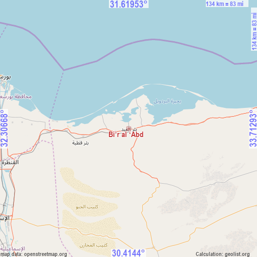
Bi’r al ‘Abd GPS coordinates[2]
31° 1' 7.932" North, 33° 0' 35.28" East
| Map corner | latitude | longitude |
|---|---|---|
| Upper-left | 31.61953°, | 32.30668° |
| Center: | 31.01887°, | 33.0098° |
| Lower-right: | 30.4144°, | 33.71293° |
| Map W x H: | 134×134 km | = 83.3×83.3mi |
| max Lat: | 31.5084° ⇑21% North |
| Bi’r al ‘Abd: | 31.01887° |
| min Lat: | ⇓79% South 22.3457° |
| min Long | Bi’r al ‘Ab | max Long |
| 25.51965° | 33.0098° | 34.89572° |
| W 88.4%⇐ | ⇒11.6% E |
Elevation
Elevation of Bi’r al ‘Abd is 12 m = 39 ft, and this is 31.5 m = 103 ft below average elevation for this country.
| Max E: |
1565 m = 5135 ft | 73.9% |
| Avg. | 43.5 m = 143 ft | |
| Bi’r al ‘Abd | 12 m = 39 ft | |
Min E: |
-15 m = -49 ft | 26.1% |
See also: Egypt elevation on elevation.city.
Geographical zone
Bi’r al ‘Abd is located in North temperate zone (between Tropic of Cancer and the Arctic Circle). Distance of this Northern Tropic circle is 843.1 km =523.9 mi to South.| Distance of | km | miles | from Bi’r al ‘Abd |
|---|---|---|---|
| North Pole | 6558.1 | 4075 | to North |
| Arctic Circle | 3952.2 | 2455.8 | to North |
| Tropic Cancer | 843.1 | 523.9 | to South |
| Equator | 3449 | 2143.1 | to South |


Nearby cities:
15 places around Bi’r al ‘Abd: (largest is in red/bold)
• Al Jammālīyah
110.5 km =68.7 mi,  279°
279°
• Al Manzalah
103.4 km =64.2 mi, 278°
• Al Maţarīyah
94.9 km =59 mi, 281°
• Al Qurayn
129.7 km =80.6 mi,  249°
249°
• Arish
76.1 km =47.3 mi,  80°
80°
• Ash Shaykh Zuwayd
107.1 km =66.5 mi, 78°
• At Tall al Kabīr
128.4 km =79.8 mi, 245°
• Damietta
122.1 km =75.9 mi,  291°
291°
• Fāqūs
120.2 km =74.7 mi, 254°
• Fāraskūr
127.9 km =79.5 mi, 285°
• Ismailia
84.2 km =52.3 mi,  236°
236°
• Port Said
73.9 km =45.9 mi, 290°
• Rafaḩ
120.5 km =74.9 mi, 75°
• Suez
125.1 km =77.7 mi,  201°
201°
• ‘Izbat al Burj
123.7 km =76.9 mi,  296°
296°
Sources, notices
• [Note1] Compared only with cities in Egypt existing in our database
• [Src1] Map data: © OpenStreetMap contributors (CC-BY-SA)
• [Src2] Other city data from geonames.org with taken over terms of usage.
• [Src3] Geographical zone / Annual Mean Temperature by Robert A. Rohde @ Wikipedia
